Mobile Mapping Redefines Pavement Marking Inventory in Ohio
It began with the Richland County Ohio Engineer’s office. They set out to inventory and inspect all their roadway pavement ...

Optimized procedures for slope inventory in Phoenix, Arizona
The American Disabilities Act (ADA) recognizes the significance of a city’s pathway infrastructure and is set out to make certain ...

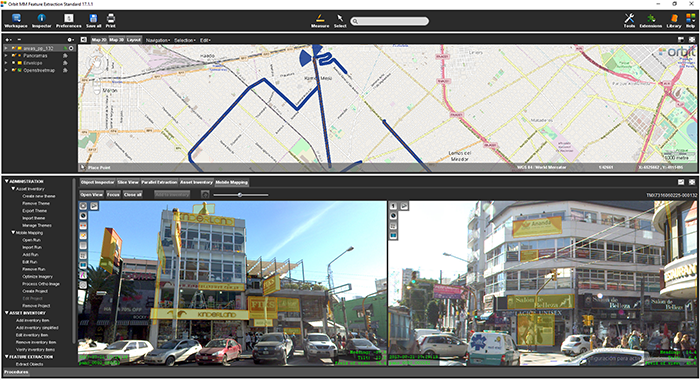
Autonomous vehicle maps in Singapore
GPS Lands Singapore took on an initiative to produce a highly detailed map for an autonomous vehicle testing area in ...

Road Management in Bern, Switzerland
Until the realisation of the herein presented solution, it was inconceivable to view several thousand kilometres of point cloud and ...
Michael Baker and BPG Designs optimize workflow and processes for Telco Industry
Mobile technology has changed the way humanity navigates its future. In the palm of our hands we are now integrated ...
Singapore Smart Nation
As part of singapore’s quest to be a smart nation, the Singapore Land Authority (sla) embarked on a 3D national ...

Bringing 3D Mapping to the people of Kuwait
In the past, people in Kuwait struggled to find a specific building. The Public Authority for Civil Information (PACI) intervened, ...
Municipality of Donostia/ San Sebastián
Open government and transparency are the key components of a modern municipal strategy. With these core principles in mind, the ...
La Matanza, Argentina, optimizes public advertising using Mobile Mapping
The survey and identification of public advertizement space for the calculation of the advertising rights of La Matanza allows the ...

Mobile Mapping to improve water utility services in Bolivia
SEMAPA, a water utility company located in the city of Cochabamba (Bolivia) launched a competitive bidding to find a company ...
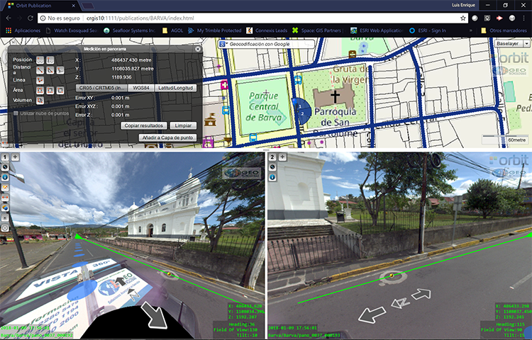
Vista 360: The digital transformation of Street Management in Costa Rica
One of the most important tasks of municipalities is managing their territory. This task is a daily challenge, because there ...
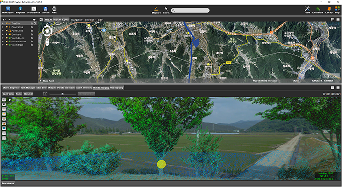
Managing Street-side trees in South Korea
This project is to construct a system for street tree maintenance that will systematically perform tasks related to street tree ...
Stockholm Public Transport: Administration Rail Asset Management
The underground metro system has a history of more than half a century and has been updated and extended over ...
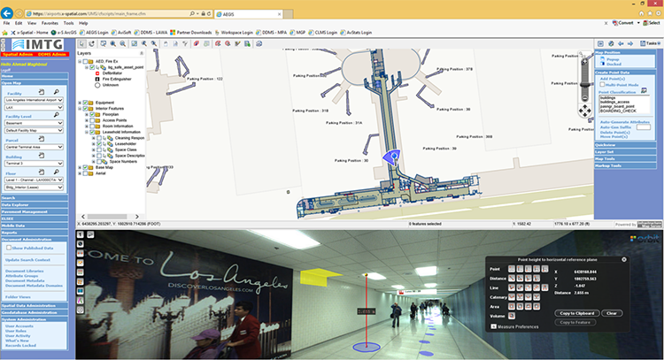
Indoor mapping at Los Angeles Airport: A Complex Spatial Story
Collecting and managing spatial data at airports is challenging. Just about everything in the airport needs to be tracked. From ...
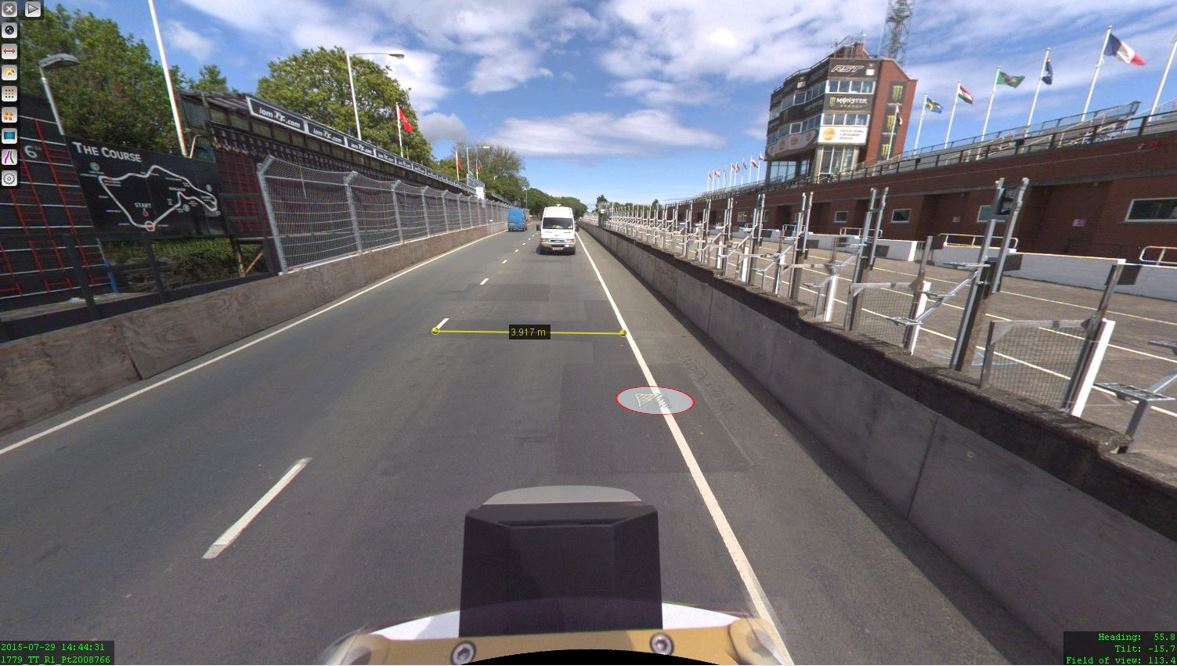
The Isle of Man: TT race mobile mapped for highway asset management and gaming
When LandScope Engineering was commissioned by the Isle of Man Government to accurately map both the TT and Southern 100 ...
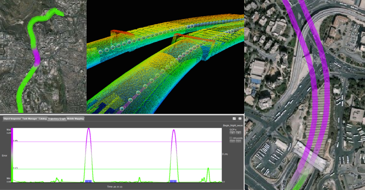
Tech Focus: Mobile Mapping a 600m tunnel in Israel
Photogrammetry is one of the most fundamental task’s Ofek Aerial Photography is doing on a daily basis. In almost every ...
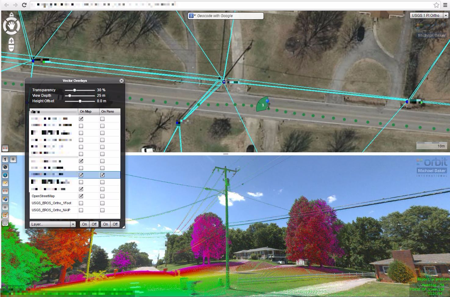
Mobile Lidar and Orbit GT
Michael baker International possesses the most comprehensive asset data collection capabilities in the industry. To help our clients maximize their ...
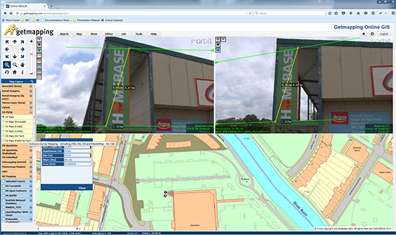
Getmapping provides UK with street imagery
Getmapping plc is a leading provider of aerial photography, mapping products and data hosting solutions in the UK and South ...
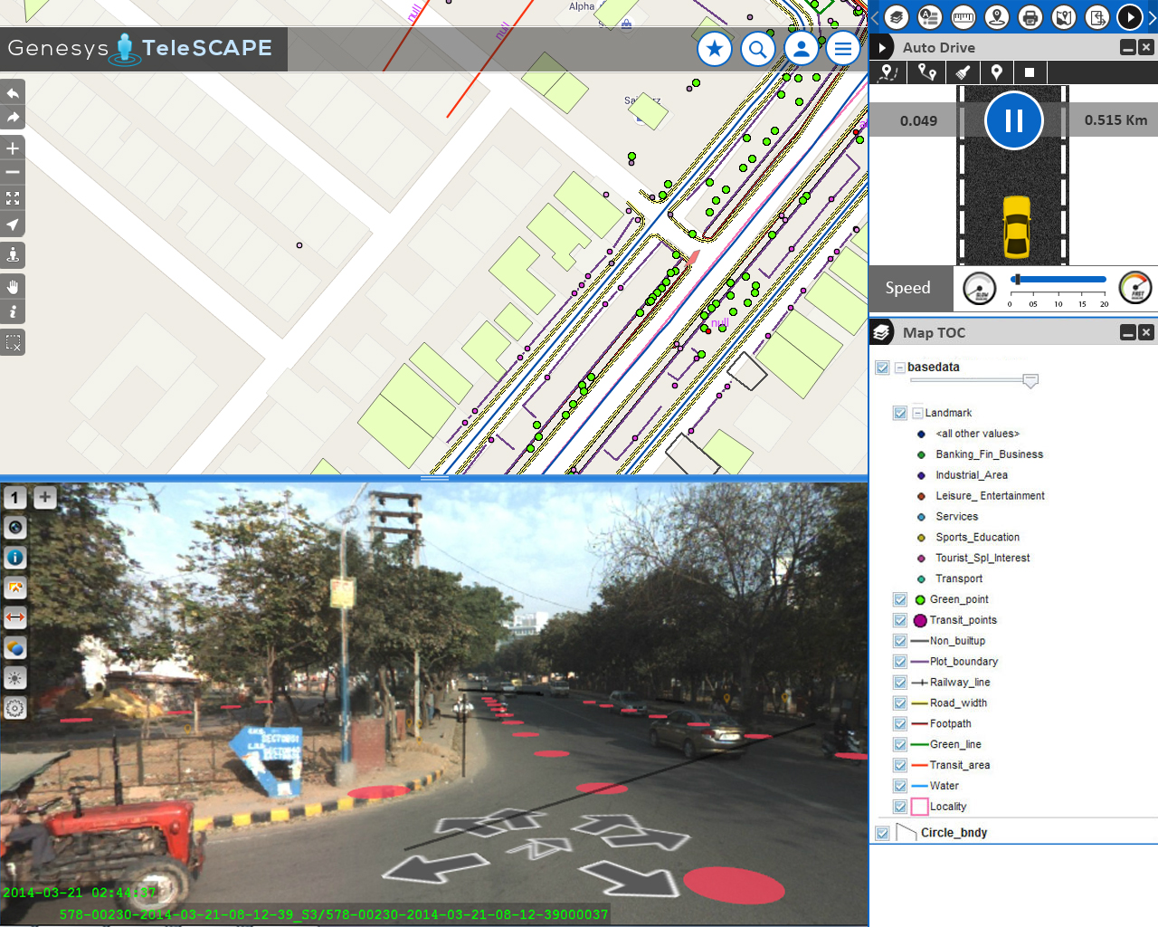
Streamlining the workflow of telecommunications in India
Besides very tight financial and inventory controls, maximum utilization of installed physical inventory and high quality of uninterrupted service to ...
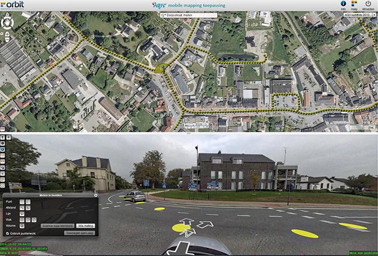
Flemish Government maps all streets
Based on a successful first round in 2008-2010, and on popular demand, the flanders geographical information agency (fgia) has decided ...