“With version 19.3, our 3D Mapping portfolio again takes a huge leap forward”, says Peter Bonne, CEO of Orbit GT. “This new release has much more to offer than you would think at first look. Improvements in every product, and quite some eye-catchers as well. Available for download today ! ”
Here are a few highlights :
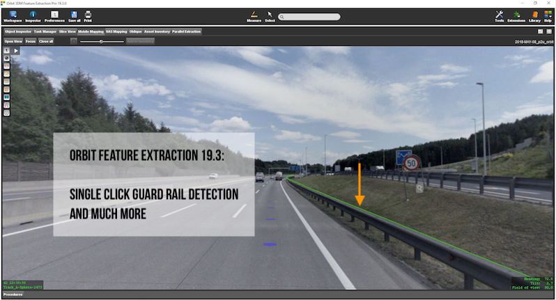
- automated measurement for guard rails (3D Measurements)
- automated measurement for pedestrian crossings (3D Measurements)
- automated 3D measurement precision fall-back system
- improved Asset Inventory Review and Edit tools
- introduction of Hybrid Resources (3D Mapping Cloud)
- Categorized 3D Models (3D Mapping Cloud)
- New SDK and Plugins (3DM Publisher and 3D Mapping Cloud)
- Optimized menus and improved functionalities (3D Mapping Cloud)
- 150+ improvements
All new versions are available for download today from www.orbitgt.com.
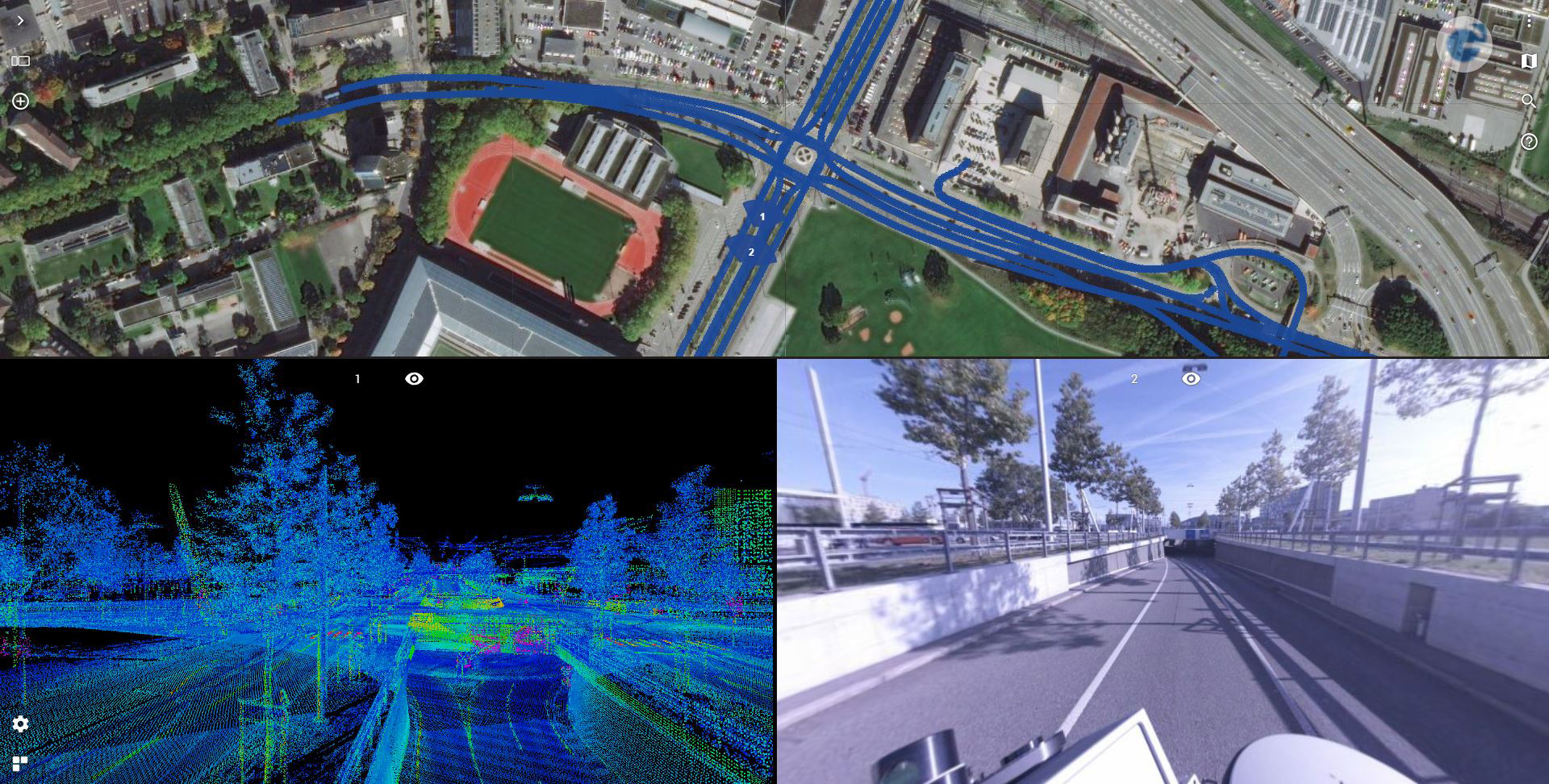
Road Management in Bern, Switzerland
Until the realisation of the herein presented solution, it was inconceivable to view several thousand kilometres of point cloud and over 1.4 million images using standard computers at a public authority ...


