“I’m happy to announce that version 19.0 is now available for download”, says Peter Bonne, CEO of Orbit GT. “Our customers can now immediately take advantage of new features and updates. This release includes all 3D Mapping products and offer a wide range of new and improved functionalities.”
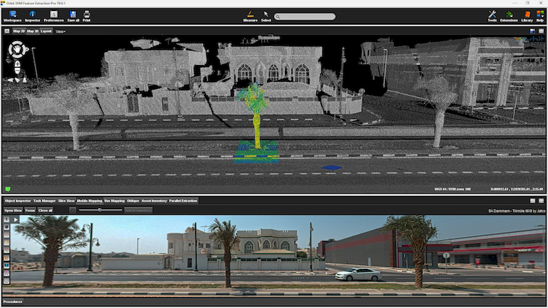
3DM Feature Extraction portfolio contains a Basic, Standard and Pro version, each offering new features and enhancements to existing tools. 3DM Content Manager and the free Upload tool also got a great update.
Main new features are :
- Automated Ground Control Point detection
- Automated multi-ridge detection
- Automated Bridge clearance
- Automated Tree inventorisation
- Slope measurements
- Linear Referencing
- Additional measurement techniques
- Various impovements and fixes
All updates are available today :
https://orbitgt.com/3dm-feature-extraction/#download
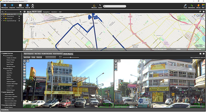
La Matanza, Argentina, optimizes public advertising using Mobile Mapping
The survey and identification of public advertizement space for the calculation of the advertising rights of La Matanza allows the city to quantify and typify all the installations and/or advertising elements through which the economic activity of a certain social actor is developed and materialized according to the ordinance tariff 2017 for the advertising rights of the municipality of La Matanza ...


