Come and visit our booth at todays largest UAS Expo in Las Vegas, Nevada, USA. Orbit GT will release and present its newest version of 3D Mapping software. This new release includes the high-end manual/semi-automated feature extraction tools, volume calculation, contour line generation, asset inventory workflow, and many more. All imagery and point cloud (LiDAR or DSM) are supported !

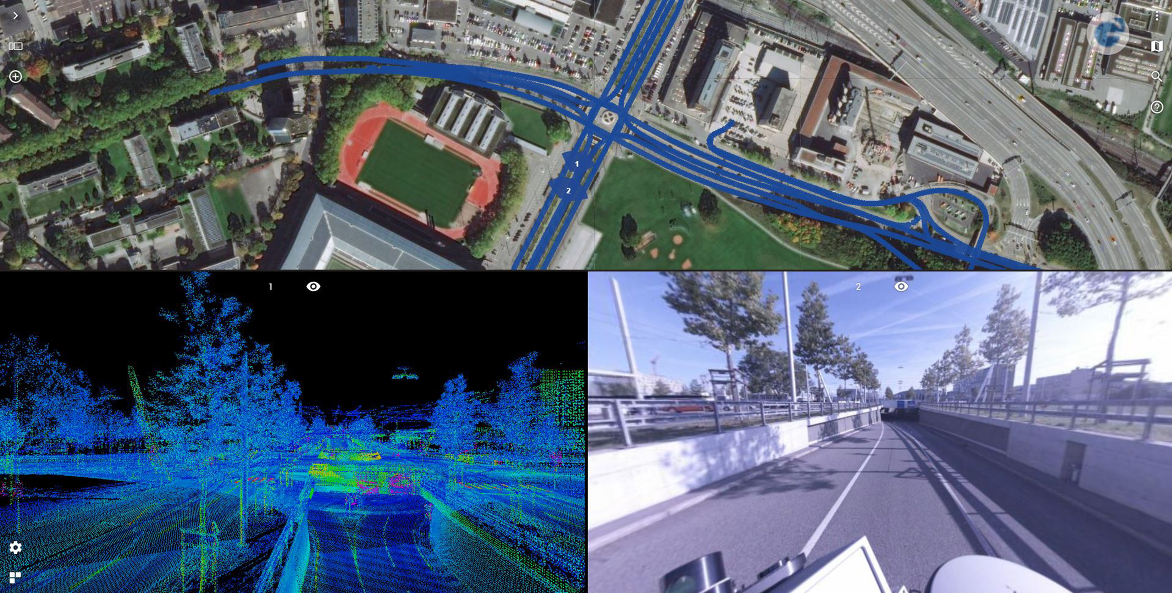
Road Management in Bern, Switzerland
Until the realisation of the herein presented solution, it was inconceivable to view several thousand kilometres of point cloud and over 1.4 million images using standard computers at a public authority ...