 |
Download in English the Orbit GT Magazine, September/October 2019
- Mobile Mapping to create Autonomous Vehicle Maps in Singapore
- Road Management in Bern, Switzerland
- Optimized Procedures for Slope Inventory in Phoenix, Arizona
- Mobile Mapping redefines Pavement Marking Inventory in Ohio, USA
- Changing the game for Telecommunications with 3D Mapping
Download in English |
 |
Download in English the Orbit GT Magazine, September/October 2018
- Singapore Smart Nation embraces 3D Land Management
- Bringing 3D Mapping to the people of Kuwait
- Donostia / San Sebastian, Spain, pioneers to publish Mobile Mapping for Citizens
- Mobile Mapping to improve Water Utility Services in Cochabamba, Bolivia
- La Matanza, Argentina, optimizes public advertising using Mobile Mapping
- Solving Public Asset Management in Costa Rica
- Managing Street-side Trees in South Korea
Download in English |
 |
Download in English the Orbit GT Magazine, September/October 2017
- X-Spatial performs Indoor Mapping for Los Angeles Airport (LAX)
- WSP Sweden delivers integrated asset solution for Stockholm Transportation Authority
- Embrace the Orbit GT SaaS platform 3D Mapping Cloud
Download in English |
 |
Download in English the Orbit GT Magazine, September/October 2016
- Michael Baker (US) and BPG Designs (US) optimize workflow and processes
for Telco Industry
- The Isle of Man: TT Race Mobile Mapped for Highway Asset Management and Gaming,
by Land-Scope, UK
- Mobile Mapping a Tunnel by Ofek, Israel
- CEO TV Interview for WorldWide Business with Kathy Ireland®
Download in English |
 |
Download in English the Orbit GT Magazine, September/October 2015
- Flemish Government maps all streets – 65 000 km of roads in 2 years.
- Geneys supplies India’s Telecom Industry
- GetMapping provides UK with Street Imagery
- The key role of Orbit GT’s Content Manager
Download in English |
 |
Download in English the Orbit GT Magazine, April 2014
- Esri The Netherlands chooses Orbit GT Mobile Mapping portfolio
- Nedgraphics (NL) integrates Orbit Mobile Mapping
- Antwerp Police (BE) uses Orbit GT’s Business Intelligence tools for pro-active traffic management
Download in Dutch |
 |
Download in English the Orbit GT Magazine, October 2013
- Mobile Mapping : Antalya (Turkey), Cobra (The Netherlands)
- UAS for Public Safety – Monitoring Music Festivals
- Opinion: How maps are made tomorrow
Download in English |
 |
Download in English the Orbit GT Magazine, April 2013
- Mobile Mapping in Government: City of Amersfoort (The Netherlands)
- Police Forces: Advanced Accident mapping
- UAS for Public Safety: Contingency Planning
- Photogrammetry in Government: City of Overbetuwe (The Netherlands)
Download in English |
 |
Download in English the Orbit GT Magazine, Sept/Oct 2012
- Mobile Mapping : San Sebastian (Geograma, Spain), Asset Inventory (land-Scope, UK)
- UAS Mapping Special : Dutch Land Registry, City of Hanoi (Vietnam)
Download in English |
 |
Download in English the Orbit GT Magazine, April 2012
- Government Cases: City of Vilvoorde (BE), Municipality of Zulte (BE)
- Public Safety: InfoCenter dispatch aid (BE police forces)
- Public Safety: Focus on Crime and Traffic (BE police forces)
Download in English |
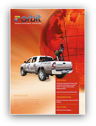 |
Download in English the Orbit GT Magazine, October 2011
- Mobile Mapping: Worldwide co-operation between Orbit GT and Topcon
- Public Safety: Crime Analysis (Belgium), Situational Awareness (Global)
- UAS: Open Air Mine Mapping
Download in English |
 |
Download in English the Orbit GT Magazine, April 2011
- Public Safety Solutions: Police of Mons (Belgium), Traffic Obstruction (Belgium)
- Municipality of Beerse (Belgium)
- Emergency Response: Public roads obstruction and real-time navigation
- Mobile Mapping using iPhone and iPad
Download in English |
 |
Download in English the Orbit GT Magazine, October 2010
- Public Safety : Antwerp adopts Digital Sketches (Belgium)
- UAS: Municipality of Zoutleeuw maps cemeteries
- Opinion: Bridging the Gap between Airborne and Mobile Mapping
Download in English |