3DM PUBLISHER – ON PREMISE
More Data. More Content. More Users.
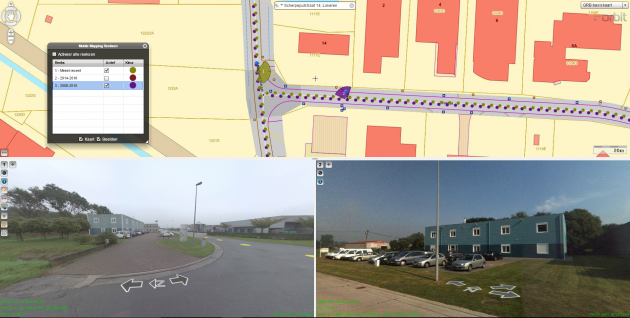
Share 360° and planar, streetview, oblique imagery
Share DSM and LiDAR point clouds online
Define user credentials, multiple publications, server pool
Share on the web, mobile devices, and integrate using the SDK
SHARE ONLINE WITHOUT LIMITS
A SERVER-BASED SOLUTION TO SHARE 3D MAPPING DATA ONLINE
PRODUCT MOVIE
FEATURES
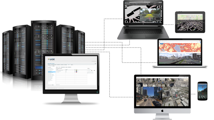
SHARE 3D MAPPING DATA TO MANY USERS
Using the 3DM Publisher on-premises, you can publish your 3D data (Mobile, Oblique, Indoor, UAS, Terrestrial) from local servers and share it over the internet to web browsers, mobile devices, embedded viewers and integrations in enterprise or customer’s workflows. Unlimited volumes of planar/panoramic imagery and point clouds are supported.
SERVER INSTALLATION, WEBCLIENT, SDK/API, PLUGINS
The 3DM Publisher product exists of a Server Software Installation (incl. Manager Console), a WebClient, API (orbit SDK), and available Plugins in Esri, AutoCAD Map, QGIS and Microstation.

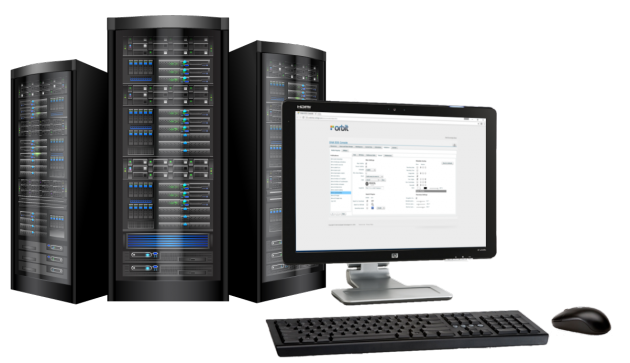
CREATE PUBLICATIONS WITH MANAGER CONSOLE
The 3DM Publisher comes with a user-friendly, online configuration console. This console contains a basic Import & setup tool for 3D Mapping content; combines 3DM projects, basemaps and other GIS data into “Publications”; allows control over Users, User Groups and their profiles; allows login-free Publication; allows logging of use; allows configurable web pages, direct link by XY or Photoname; defines connectivity by URL, Username and Password.
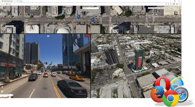
PUBLISH VIA WEB
The access via a WebClient for streetview planar and panorama images, UAV nadir and Aerial oblique pictures are included in the Orbit 3DM Publisher. Access your shared 3D Mapping data via any web browser. Use your login and password to view, navigate, overlay, measure, and extract. Two different web clients (Flash-based and HTML5) are available for the 3DM Publisher on-premises. Please read carefully the production comparison list to check available features for each type of WebClient.
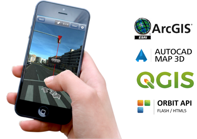
PUBLISH IN 3RD PARTY WORKFLOW
If you want to integrate a plugin in your own workflow or work via a 3rd party software, have a look at our free 3DM Plugins (and API) for ArcGIS for Desktop, AutoCAD Map, QGIS, etc.
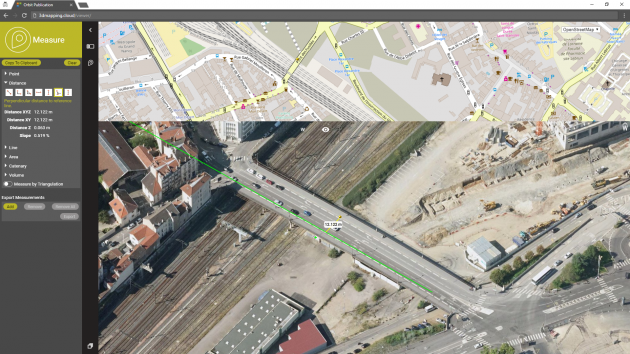
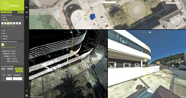
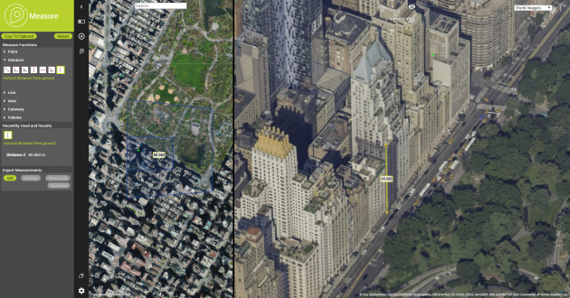
SIMPLE AND POWERFUL MEASUREMENTS
Measure, attribute and extract points, distances, poly(lines), areas, and simple volumes. Measure on any of the available views. Measure using images only, on the image but using point cloud behind, on the 3D point cloud, 2D Map, etc. Multiple results will be presented. Finally, download the results and share.
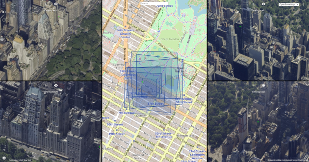
SHOW FOOTPRINTS ON BASEMAP
Get insight in oblique viewing angles and position with realtime footprint information. The overlay of the image footprint is the ideal way to navigate: keep your focus on predefined locations while zooming and panning.
MEASURE POSITION, DISTANCE, LINE, OR AREA IN OBLIQUE IMAGES
Measurements can be made using a DEM or triangulation. Single-click measurements require a DEM. With the measurement HUD, tools to measure coordinates, distances, heights, and areas are just one click away.
PUBLISH & REQUEST METADATA
Improve your visualization by adjusting the image brightness. Set your own view composition. And request the included metadata of your mobile mapping data.
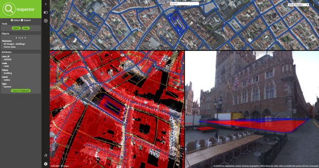
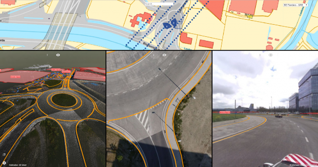
OVERLAY ANY VECTOR DATA OVER MAP AND PANORAMA
Publish vector data together with Mobile Mapping data. Include WFS services in Publication. Dynamically switch on/off each layer on Map and/or Panorama. Adjust height for 2D data. Control vector data view depth. Control overlay transparency.
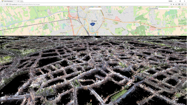
FULL 3D POINT CLOUD VIEW
Using the HTML5 WebClient, there is a full 3d point cloud view available. Navigate easily through terabytes of point cloud data. Measure and extract 3D data based on any 3D LiDAR or DSM point cloud coming from Aerial, Outdoor, or Indoor Mapping.
SHARE MULTIPLE YEARS
Configure an Object Search for vector layers or a geocoding search plugin. Record a snapshot with the required metadata. Manage several years of mobile mapping data. Make objects selectable and request attribute information.
MEASURE AND EXTRACT
When sharing data several intelligent measurement functions are available for the user. Measure and extract data in Oblique, Indoor, Mobile, and UAS Mapping publications. Measure points, lines, polylines, areas, volumes, and circles. Export and save the results after each session.