Come and visit our booth at todays largest UAS Expo in Las Vegas, Nevada, USA. Orbit GT will release and present its newest version 17.0 of UAS Mapping software. This new release includes the high-end manual/semi-automated feature extraction tools, volume calculation, contour line generation, asset inventory workflow, and many more. All imagery and point cloud (LiDAR or DSM) are supported !
Get your copy of our UAS Mapping version 17 here !
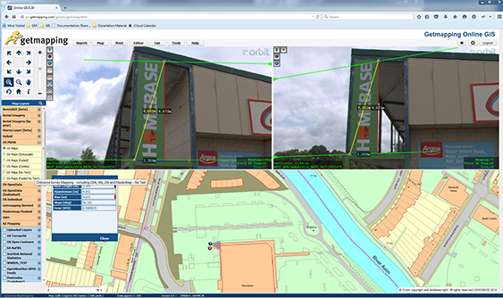
Getmapping provides UK with street imagery
Getmapping plc is a leading provider of aerial photography, mapping products and data hosting solutions in the UK and South Africa. Founded in 1998, Getmapping was the first organisation to create a complete photographic record of the UK, called the Millennium Map. Since then, Getmapping has expanded to provide Web Services (WMS, WFS, INSPIRE), hosted GIS and consultancy to a range of industries in the public and private sector ...