Municipality of Donostia/ San Sebastián
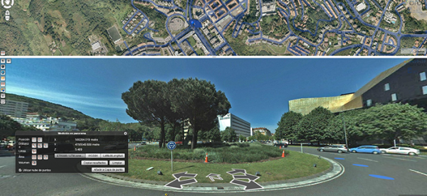
Open government and transparency are the key components of a modern municipal strategy. With these core principles in mind, the city council of Donostia/San Sebastián decided to embed Orbit 3DM Publisher in its web environment, in order to provide its citizens with the most accurate and up-to-date maps of the city ...
Read More
Read More
This new generation of embedded tools reinforces the commitment of the City Council to open government and transparency: we make available to all citizens the information we generate in our everyday life
Upcoming events
No posts found.