Come and visit our booth at todays largest UAS Expo in Las Vegas, Nevada, USA. Orbit GT will release and present its newest version of 3D Mapping software. This new release includes the high-end manual/semi-automated feature extraction tools, volume calculation, contour line generation, asset inventory workflow, and many more. All imagery and point cloud (LiDAR or DSM) are supported !

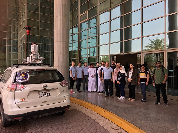
Bringing 3D Mapping to the people of Kuwait
In the past, people in Kuwait struggled to find a specific building. The Public Authority for Civil Information (PACI) intervened, inventing an address system that is unique in the world: The ‘Kuwait Finder’, an application for the public, governmental and private sectors. PACI now intends to also provide a full 3D map service for the country, which will allow users to see the streets of Kuwait in realistic 3D panoramic ...