Come and visit our booth at todays largest UAV Expo in Las Vegas, Nevada, USA! With over 170 booths and 1,720 commercial attendees, the Commercial UAV Expo is the best choice for professionals who need to keep up-to-date on technology, trends and developments for drone mapping applications.
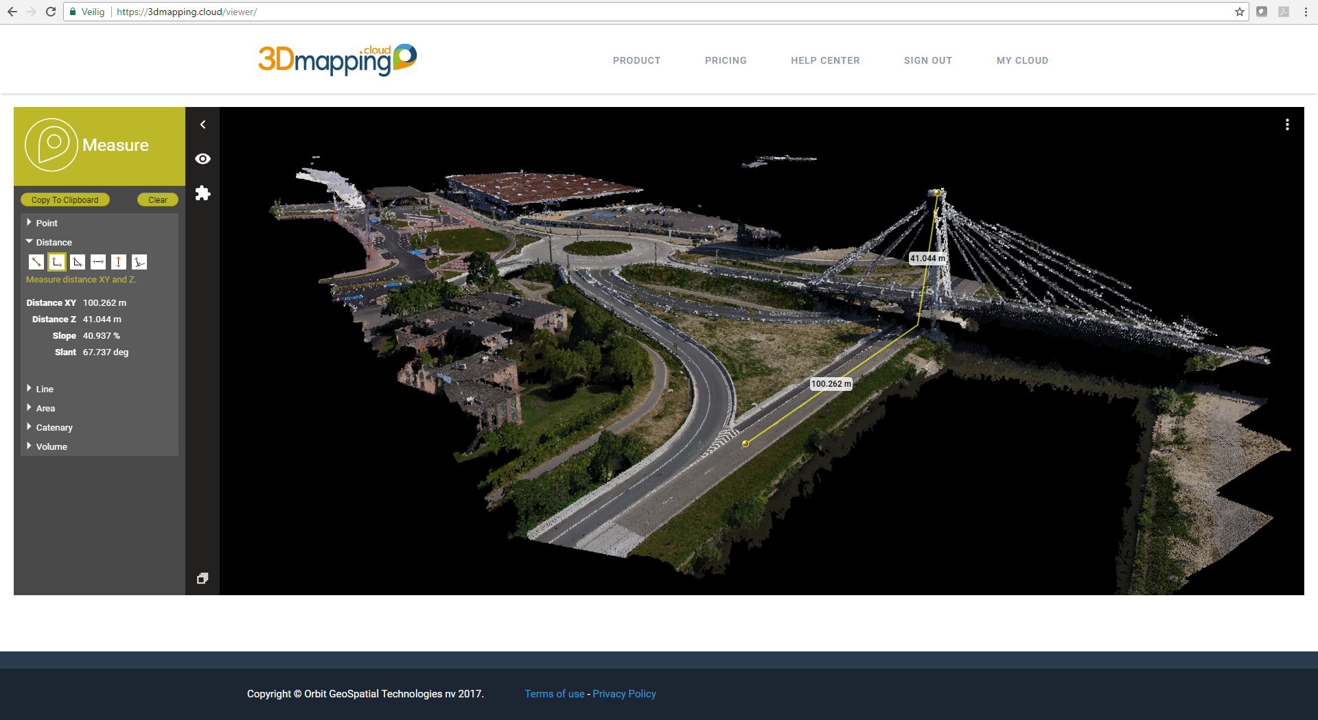
Orbit GT will present their brand new released Desktop and Cloud portfolio for Version 18 which bundles from now on all the Orbit expertise domains in a single portfolio. Streetview, Terrestrial, Indoor/Outdoor Mapping, and UAS Mapping, all are managed through a single portfolio. This is next to being quite beneficial also an optimization of the workflows, allowing the UAS mapping operators to use the same solutions for various complex data sources. As Orbit GT we experience many of our UAS Mapping customers using several techniques of reality capture, such as Mobile Mapping data and Terrestrial scans, we worked towards an integration of our portfolio to offer a single product line covering the needs for each of these domains. This native integration is a sure win for every UAV customer and user. And of course there are piles of new and improved features, with a few eye-catchers on automated feature detection and recognition, and the easy sharing of 3D Mapping data via our cloud-based ‘3D Mapping Cloud’ platform.
Visit us in Las Vegas: The Westgate Resort
Tuesday October 22nd: 5:00pm – 6:30pm
Wednesday October 23rd: 8:00am – 7:00pm
Thursday October 24th: 8:00am – 4:00pm

Westgate Resort & Casino
3000 Paradise Rd
Las Vegas, NV 89109
Autonomous vehicle maps in Singapore
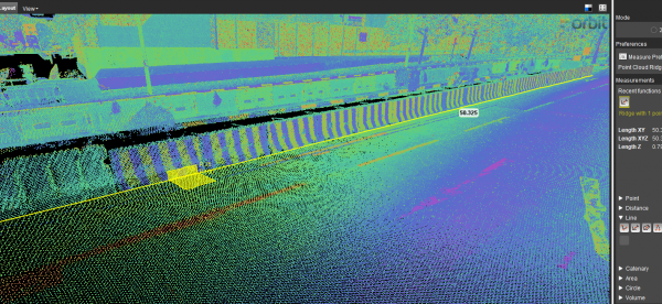
GPS Lands Singapore took on an initiative to produce a highly detailed map for an autonomous vehicle testing area in Singapore using 3D Mobile Mapping system to collect the data and perform feature extraction using the 3D data ...
Read More
Read More
Using the 3DM Feature Extraction Pro allows semi-automated extraction of road features such as lane markings and curb lines, using the automatic detection of traffic signs and poles helps in identifying the location of all the traffic signs and traffic light poles where the operator is able to extract all the accepted detections.
Upcoming events
No posts found.