Orbit GT and RIEGL today strengthen data interoperability for terrestrial scanning by making data exchange between software systems much easier than before.
“Orbit GT and RIEGL share a common view that data interoperability should be as easy as possible, also for quite complex and large datasets, as are abundant in the scanning business”, says Peter Bonne, CEO of Orbit GT. “We are very happy with the effort that the RIEGL team has done to bring this interoperability to the next level and make results from terrestrial scanning ready for our portfolio of LiDAR and Imagery data management, feature extraction and publishing software.”
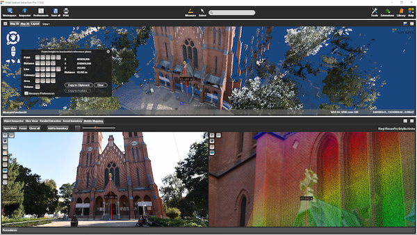
“In our efforts to provide the best solutions for the client, we team up with software industry leaders like Orbit GT. Providing georeferenced panorama image exports with the latest release of RiSCAN PRO is another step towards our common goal of eroding the barrier between kinematic and static laser scanning and process the data in a shared environment such as Orbit’s MM Feature Extraction Bundle Software ”, says Christian Sevcik, Manager Strategic Software Alliances. “ With this update, it has never been easier to combine LiDAR data and imagery collected with a static laser scanner like the RIEGL VZ-400i with mobile mapping data. “
Mobile Lidar and Orbit GT
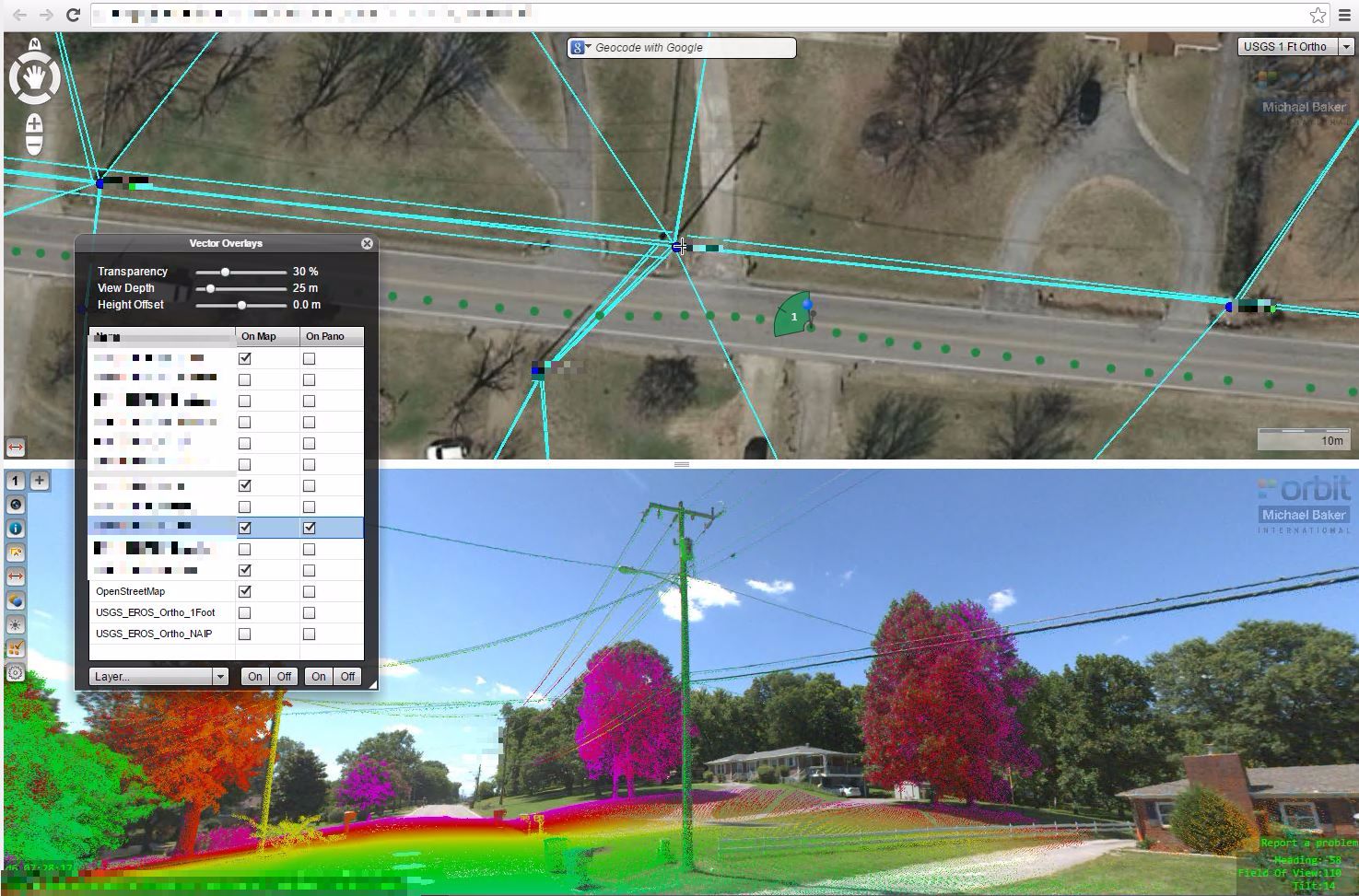
Michael baker International possesses the most comprehensive asset data collection capabilities in the industry. To help our clients maximize their resources Michael baker has implemented a web-based solution on our BEAST environment (baker enterprise Architecture for spatial Technologies) that leverages the orbit framework to link panoramic imagery, GIS/CAD features, and LiDAR point clouds into a single integrated solution that can be accessed from any of the most popular internet browsers ...


