
Orbit GT releases a major update of it’s game-changing SaaS product 3D Mapping Cloud.
“3D Mapping Cloud is no doubt the most powerful a versatile online platform for large 3D resources,”, says Peter Bonne, CEO of Orbit GT. “Today we launch another update with a series if innovations and improved functionalities, empowering Oblique Imagery, UAV Mapping, Indoor and Terrestrial Scanning and street level Mobile Mapping multi-sensor content to be stored, organized, and shared amongst colleagues, contractors and customers in the most flexible way.”
Update highlights :
– Introduction of Resource Groups. Now make a virtual resource based on a set of smaller units and share in one go.
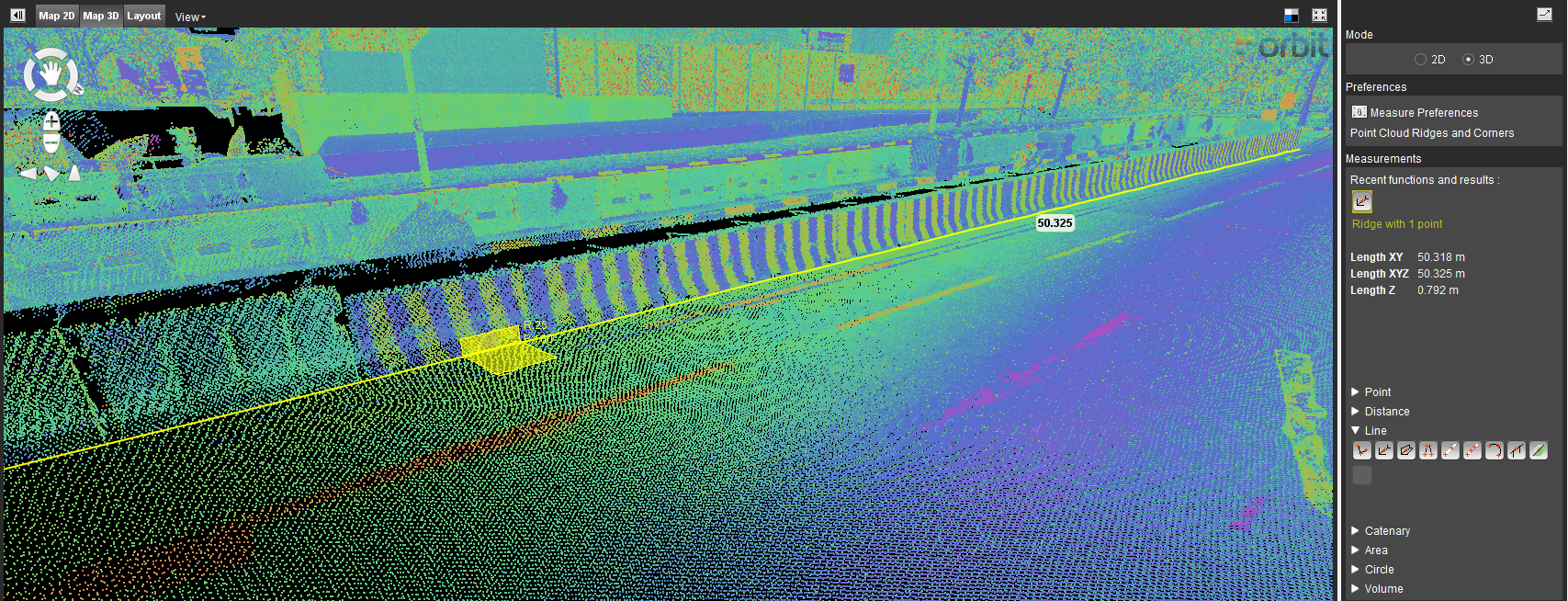
– Attribute Measurements before download
– Full power point cloud colorization to set out details much better than ever before.
– Support multiple Data Centers (Any Azure Data Center can now be ‘switched on’ upon request.
– Viewer now uses full webpage
– New Viewer Catalog layout
– Set Unit preference
– Manage basemaps for Publications
– Delete a Resource form the Console
– Many tweaks and fixes
In the image : Making multiple measurements with attributes, ready to download.
Autonomous vehicle maps in Singapore
GPS Lands Singapore took on an initiative to produce a highly detailed map for an autonomous vehicle testing area in Singapore using 3D Mobile Mapping system to collect the data and perform feature extraction using the 3D data ...


