3D Mapping content is created in many different industries, and people tend to use similar yet different mechanics to capture the data. In many cases, the data is processed to make it accessible for the trained or non-trained eye.
But whichever case now pops into your mind, it is very likely that it’s not going to be a one-fits-all technique. Moreover, in my opinion, one should be free to use any capture technique that is best to do what needs to be done, not restricted by the question “How am I going to use that afterward?”
Avoid Vendor Lock-in
3D Data Capture, and the long trail behind it, is too often presented as a silo solution where the customer is stuck in a vendor-lock-in or a black-box solution. Personally, I don’t like that. I consider this a bad way of doing business: trying to convince your customer of providing something great, while basically, all you do is tieing him down for a number of years. But don’t be fooled: you will need alternatives pretty soon, you probably just don’t know it yet and these vendors will not tell you that.
We’ve been in the business for over 50 years, and fusion of various types of data has always been the norm. When you’re a map producer, it’s simply inevitable. Even the one-man surveyor uses different instruments, so why should you believe you don’t need it?
Let me explain what happens. Quite some hardware manufacturers or service providers try to convince you that they offer a solution which represents your needs. In reality, they present a vendor-lock-in that they may have been building on their own, explaining you won’t need something else, or that an alternative would be much too complicated, or it simply doesn’t exist. Or better: they won’t even mention the options.
A One-size-fits-all Solution is right here.
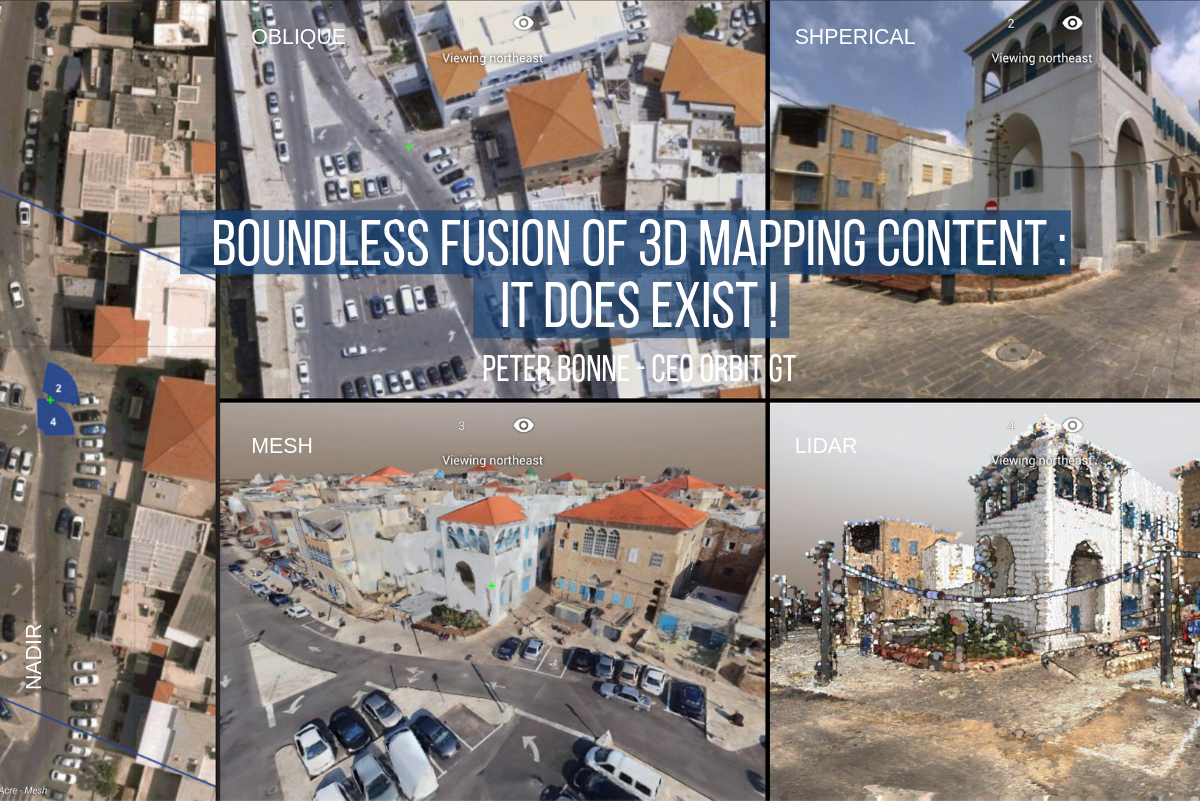
But you do have options. You have the choice to pick a solution that fits your needs today and tomorrow. A solution that covers any type of 3D mapping data, whether it’s street-level mobile mapping, drone pictures, aerial lidar of imagery, static or mobile mapping, indoor scanning and so forth. A solution that supports imagery as well as point clouds as well as textured meshes and photorealistic representations as well as 3D models as well as your good old vector-based GIS databases as well as … All data neatly fused together, on the fly. Yes, it’s possible, and it’s not complicated nor expensive!
Is it a magician’s work? Is it extraterrestrial? Nope, it’s just 3dmapping.cloud. And it maximizes on the web what has been possible on your desktop for quite a while now. A repository helps to manage your content, share it amongst viewers inside and outside your organization, set up projects and teams, and configure a formal Publication that helps to streamline all this in a blink of an eye, even for the public at large. So easy. In your browser and integrated into your favorite business application.
Don’t let anyone trick you into a vendor-lock-in. You’re smarter than that!
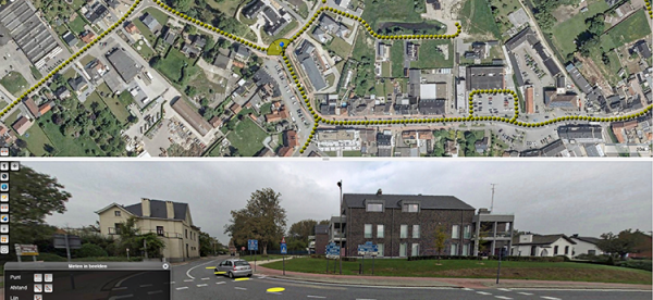
Flemish Government maps all streets
Based on a successful first round in 2008-2010, and on popular demand, the flanders geographical information agency (fgia) has decided to tender a second round of mobile mapping, covering all issues learned from round one ...
Read More
Read More
The acquisition requires the combination of high resolution images and 3D-point clouds to allow for detailed observations and measurements.