
Orbit GT and LiDAR USA have significantly upgraded their Scanlook and Snoopy interoperability.
“Interoperability is key to any user of Mobile Mapping data”, says Peter Bonne, CEO of Orbit GT. “Improving this process increases reliability and processing speed, which results in a faster turnaround for a project at large. By adding these features especially for the successful Scanlook and Snoopy products, we express our continued support and engagement to provide the best tools for the market. We’re happy to have reached such improvement with the LiDAR USA team. ”
Clients often ask, “So I have all of this LIDAR data, now what?” A very good answer is Orbit GT. “While our ScanLook systems make it easy to capture the data in the field and generate nice point clouds, the end client wants GIS or CAD data. Orbit GT offers a very nice experience take to extract this information,” says Daniel Fagerman, CTO of LIDAR USA
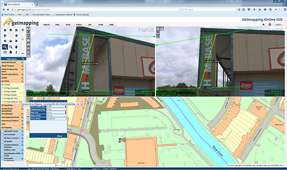
Getmapping provides UK with street imagery
Getmapping plc is a leading provider of aerial photography, mapping products and data hosting solutions in the UK and South Africa. Founded in 1998, Getmapping was the first organisation to create a complete photographic record of the UK, called the Millennium Map. Since then, Getmapping has expanded to provide Web Services (WMS, WFS, INSPIRE), hosted GIS and consultancy to a range of industries in the public and private sector ...


