Orbit GT organises 9 live presentations at their Intergeo booth C4.025. Attend the presentation and get your free coupon for 3D Mapping Cloud. Presentations are held every day at 10:00, 12:00 and 15:00.
“3D Mapping Cloud offers disruptive new capabilities in handling and using massive 3D data”, says Peter Bonne, CEO of Orbit GT. “Our presentations aim to show the unique features wit which 3D Mapping Cloud can help your business and projects, and save a lot of money in doing so. As a token of appreciation, we offer each attendee a coupon for 1 month free use of 3D Mapping Cloud.”
3D Mapping Cloud bundles all our expertise domains in a single SaaS platform. Mobile Mapping, UAS Mapping, Oblique or Indoor Mapping, and Terrestrial scanning that increasingly includes imagery, all are brought online, shared, fused and published with only 1 platform. It’s the only single platform to host all of your data and have it instantly accessible for all co-workers and business partners at once. And with the SDK, you can bring it into any workflow.
As we experience many of our customers using several techniques of reality capture, such as Mobile Mapping and UAS Mapping, we worked towards an integration of our portfolio to offer a single product line covering the needs for each of these domains. This native integration is a sure win for every customer and user.
Visit us at Intergeo, Berlin, September 26-28, at the Berlin Messe, booth C4.025.
Mobile Lidar and Orbit GT
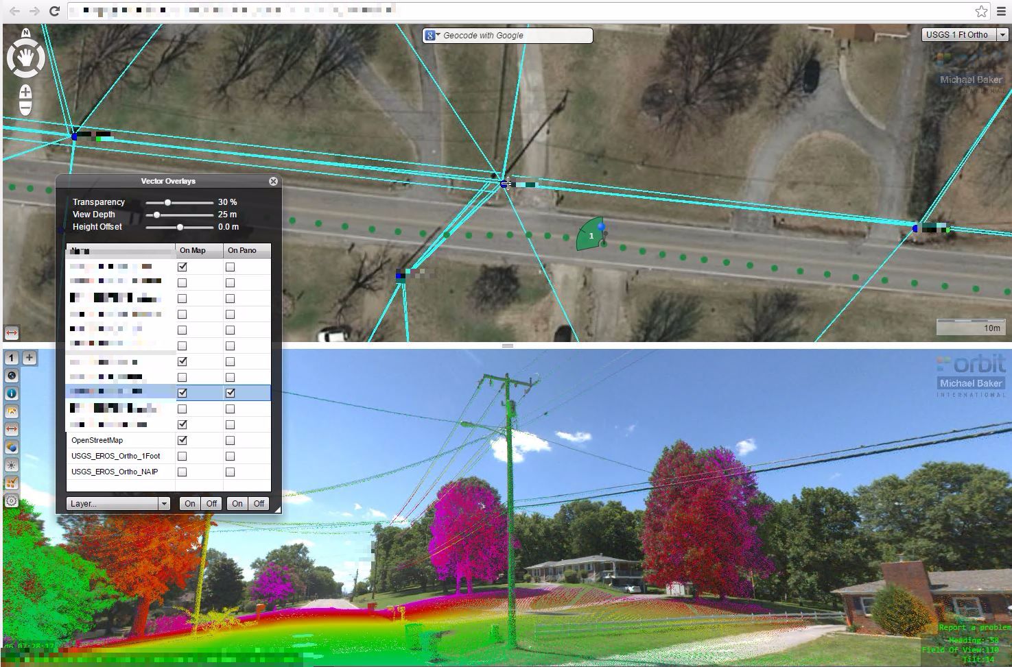
Michael baker International possesses the most comprehensive asset data collection capabilities in the industry. To help our clients maximize their resources Michael baker has implemented a web-based solution on our BEAST environment (baker enterprise Architecture for spatial Technologies) that leverages the orbit framework to link panoramic imagery, GIS/CAD features, and LiDAR point clouds into a single integrated solution that can be accessed from any of the most popular internet browsers ...


