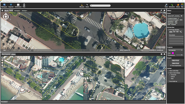
“Oblique Mapping v17 is cool upgrade”, says Peter Bonne, CEO of Orbit GT. “Whilst having improved import and support for many more camera systems, we’ve added some cool features that adds significantly to the user experience and the feature extraction capabilities.”
Orbit Oblique Mapping supports all oblique camera systems, and has documented procedures for Vexcel Imaging, MIDAS, ASPRS conform specifications and others. Through the addition of a camera-choice setting, systems with more than 4 camera’s are now also supported.
Orbit Oblique Mapping allows measurements, feature extraction, vector overlays and many more. It’s the most complete product to exploit any oblique imagery for any application.
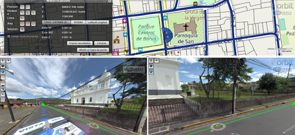
Vista 360: The digital transformation of Street Management in Costa Rica
One of the most important tasks of municipalities is managing their territory. This task is a daily challenge, because there are many variables: the maintenance of streets, sidewalks, piping, signage, trade, education, housing and factories. Not to mention the constant search for a balance between the quality of life of citizens and a responsibility for the environment ...
Read More
Read More
It has always been a challenge, not just to take daily measurements in order to take effective actions, but also to properly record these measurements.


