
Orbit GT will be showcasing it’s Mobile Mapping portfolio; the most complete offering in the world.
“Capturing Reality wouldn’t be complete without Orbit GT’s unique end-to-end offering for Mobile Mapping”, says Peter Bonne, CEO of Orbit GT. “At this year’s event, we”ll be presenting new features of our portfolio, achieving even faster results with less efforts. Come visit us at booth 21.”
The Orbit Mobile Mapping portfolio covers production, extraction and sharing/publishing in an integrated and optimized workflow. The proven products are each market-leading in their flexibility and capability to support any data source.
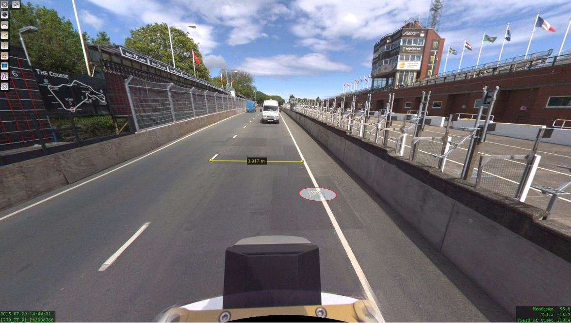
The Isle of Man: TT race mobile mapped for highway asset management and gaming
When LandScope Engineering was commissioned by the Isle of Man Government to accurately map both the TT and Southern 100 routes for the purposes of highway asset inventory and visualisation and to meet future 3D gaming and simulation requirements, a compelling and innovative solution was required ...


