
Orbit GT and LiDAR USA have significantly upgraded their Scanlook and Snoopy interoperability.
“Interoperability is key to any user of Mobile Mapping data”, says Peter Bonne, CEO of Orbit GT. “Improving this process increases reliability and processing speed, which results in a faster turnaround for a project at large. By adding these features especially for the successful Scanlook and Snoopy products, we express our continued support and engagement to provide the best tools for the market. We’re happy to have reached such improvement with the LiDAR USA team. ”
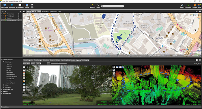
Clients often ask, “So I have all of this LIDAR data, now what?” A very good answer is Orbit GT. “While our ScanLook systems make it easy to capture the data in the field and generate nice point clouds, the end client wants GIS or CAD data. Orbit GT offers a very nice experience take to extract this information,” says Daniel Fagerman, CTO of LIDAR USA
Singapore Smart Nation
As part of singapore’s quest to be a smart nation, the Singapore Land Authority (sla) embarked on a 3D national mapping initiative in 2014. This initiative aims to create and maintain an accurate national 3D map that is developed once and used by many ...


