Challenge
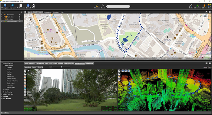
As part of singapore’s quest to be a smart nation, the Singapore Land Authority (sla) embarked on a 3D national mapping initiative in 2014. This initiative aims to create and maintain an accurate national 3D map that is developed once and used by many. The main objectives are to have high-resolution data in order to meet the requirements of most government agencies, to have an open standard data exchange format for interoperability and data sharing, to have a common, authoritative 3D base map to support collaboration among agencies and to create a workflow for continuous maintenance to ensure currency of data.
Solution
By using and exploring advanced mapping technologies, it was clear that 3D laser scanning with imagery is the best available solution that addresses the considerations for collecting 3D data. Orbit technology was used to manage the contents of the downstream mobile laser scanned and imaged data.
Result
The ease of use and the interaction of these high-quality datasets with Orbit tools have opened up many possibilities for stakeholders within the governmental agencies to efficiently manage features and assets of interest. Orbit GT is proud to play a part in singapore’s smart nation quest.
Download in-depth case

Loved by ...