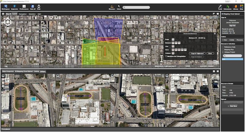
Orbit GT releases v17.1 of its Oblique Mapping desktop product including the all-new Upload to the Cloud feature. It is available for download today from our website www.orbitgt.com.
“This upgrade includes the capability to upload any Oblique Mapping content directly to www.3dmapping.cloud, our SaaS based sharing and collaboration platform”, says Peter Bonne, CEO of Orbit GT. “It adds a great new feature for everyone producing and exploiting oblique aerial imagery.”
‘Upload to the Cloud’ allows for users to instantly bring Oblique Aerial imagery data online. The upload process is fluently integrated in the known workflows of the product, with the required checks and validations. Upload time depends on your internet connection. Once uploaded, the data is immediately available for sharing on www.3dmapping.cloud. The new Catalog tool adds insight and overview of all data collection jobs done, indispensable to manage large jobs.
This product is available for download today on www.orbitgt.com. This update is free for holders of a license with maintenance.
Municipality of Donostia/ San Sebastián
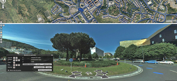
Open government and transparency are the key components of a modern municipal strategy. With these core principles in mind, the city council of Donostia/San Sebastián decided to embed Orbit 3DM Publisher in its web environment, in order to provide its citizens with the most accurate and up-to-date maps of the city ...
This new generation of embedded tools reinforces the commitment of the City Council to open government and transparency: we make available to all citizens the information we generate in our everyday life


