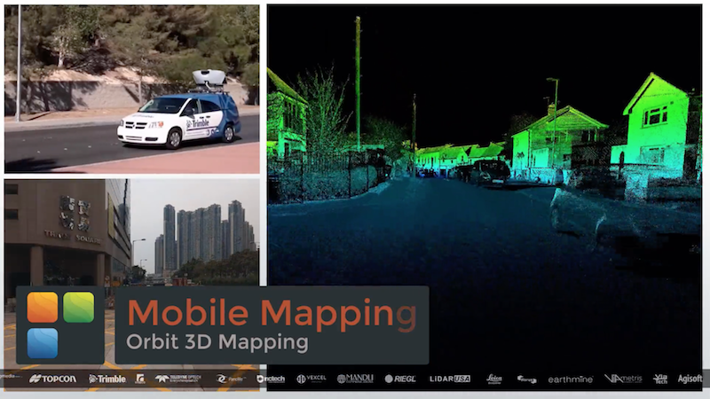
Orbit GT to showcase new v18 for Mobile, UAS, Indoor and Aerial Mapping at Intergeo, Berlin
“I’m thrilled to announce version 18 to be shown at Intergeo, Berlin”, says Peter Bonne, CEO of Orbit GT. “Version 18 of our Desktop and Server portfolio bundles all our expertise domains in a single portfolio. So now, Mobile Mapping, UAS Mapping, Oblique or Indoor Mapping, all are managed through a single portfolio. For our customers, this is next to being quite beneficial also an optimization of the workflows, allowing the same operators to use the same solutions for various complex data sources.”
As we experience many of our customers using several techniques of reality capture, such as Mobile Mapping and UAS Mapping, we worked towards an integration of our portfolio to offer a single product line covering the needs for each of these domains. This native integration is a sure win for every customer and user.
And of course there are piles of new and improved features, with a few eye-catchers such as automated feature detection and recognition, traffic sign detection and more.
Visit us at Intergeo, Berlin, September 26-28, at the Berlin Messe, booth C4.025
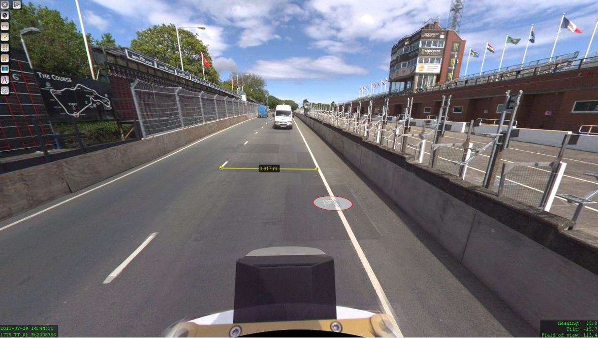
The Isle of Man: TT race mobile mapped for highway asset management and gaming
When LandScope Engineering was commissioned by the Isle of Man Government to accurately map both the TT and Southern 100 routes for the purposes of highway asset inventory and visualisation and to meet future 3D gaming and simulation requirements, a compelling and innovative solution was required ...


