Orbit GT will exhibit at next week’s TRB event in Washington DC, USA.
“With our strong focus on 3D Mapping, Orbit GT enjoys many customers in the transportation business. At this year’s event, we’re showcasing fully automated Pole and Bridge Clearance Detection tools, for sure solving some of the pain points for many DOT’s”, says Peter Bonne, CEO of Orbit GT.
As the current version 18 bundles all the expertise and technology to support the various types of 3D mapping techniques, street level Mobile Mapping can be instantly combined with UAV and terrestrial data collection, offering rich data analysis capabilities. Semi- and full autodetection tools speed up conversion of raw 3D capture data to actionable information in DOT’s day-to-day operations.
Come visit us in booth 366.
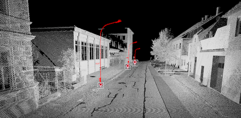
In the image : Autodetected light poles, highlighting the complete pole in the point cloud, with registered anchor points in the GIS/CAD database.
Streamlining the workflow of telecommunications in India
Besides very tight financial and inventory controls, maximum utilization of installed physical inventory and high quality of uninterrupted service to the customers, the biggest challenge faced by every Indian telecom company is the absence of a unified platform on which information pertaining to right of way, cable layout location and plans as well as individual asset locations are available ...


