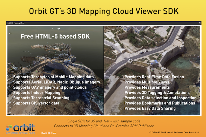
Orbit GT releases free SDK/API for HTML5 Viewer supporting the 3D Mapping Cloud SaaS platform and the On-Premise 3DM Publisher.
“What is GIS or Mapping if you can’t integrate it in your workflow ? In Orbit GT’s vision, integration is key”, says Peter Bonne, CEO of Orbit GT. “We’ve been working very hard to build a stable, performant, flexible, yet very simple SDK to allow integrations of any 3D Mapping data into a customer’s workflow. This SDK includes all capabilities of the 3D Mapping Cloud Viewer, is free to be used, and can be embedded in any web-based or desktop-based application and workflow. No limits. Great results.”
The SDK supports all 3D Mapping content hosted by 3D Mapping Cloud or the on premise 3DM Publisher : Mobile Mapping, Aerial LiDAR and Oblique imagery, Indoor scanning, UAV content, and much more. All fused together on the fly.
3D Mapping Cloud is Orbit GT’s SaaS platform designed to host, process and share massive volumes of LiDAR, Imagery and other reality capture data, however it has been collected. It supports high resolution Mobile Mapping as well as aerial Oblique mapping, each with fully automated adapted viewer behavior. Equal user experience is provided in the SDK.
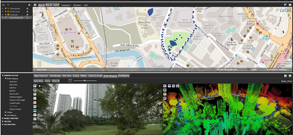
Singapore Smart Nation
As part of singapore’s quest to be a smart nation, the Singapore Land Authority (sla) embarked on a 3D national mapping initiative in 2014. This initiative aims to create and maintain an accurate national 3D map that is developed once and used by many ...
We will continue to invest in equipping our team to be the best for the sole interests of our valued customers, who have placed their trust in us and supported us all these years.


