Orbit GT supports NCTech’s superb iSTAR Pulsar data to be integrated into its smart 3D mapping solutions.
“We’re very pleased to announce that Orbit GT solutions now support data from NCTech’s iSTAR Pulsar,” said Peter Bonne, CEO, Orbit GT. “We’ll be showcasing the great 360 degree imagery captured by iSTAR Pulsar at our booth.”
“We launched iSTAR Pulsar earlier this year, so it’s great to see that key industry players like Orbit GT are already leveraging its capabilities in their own developments,” said Andy Baddeley, Technical Sales Director, NCTech. “We look forward to showing everyone at INTERGEO how we are helping to virtualize the world!”
iSTAR Pulsar is NCTech’s professional edge-to-cloud big data system, optimized for capture on the move. iSTAR Pulsar is designed to capture 360-degree data while mounted on a vehicle, drone or on foot.
Check out iSTAR Pulsar images: https://goo.gl/SB7dPB
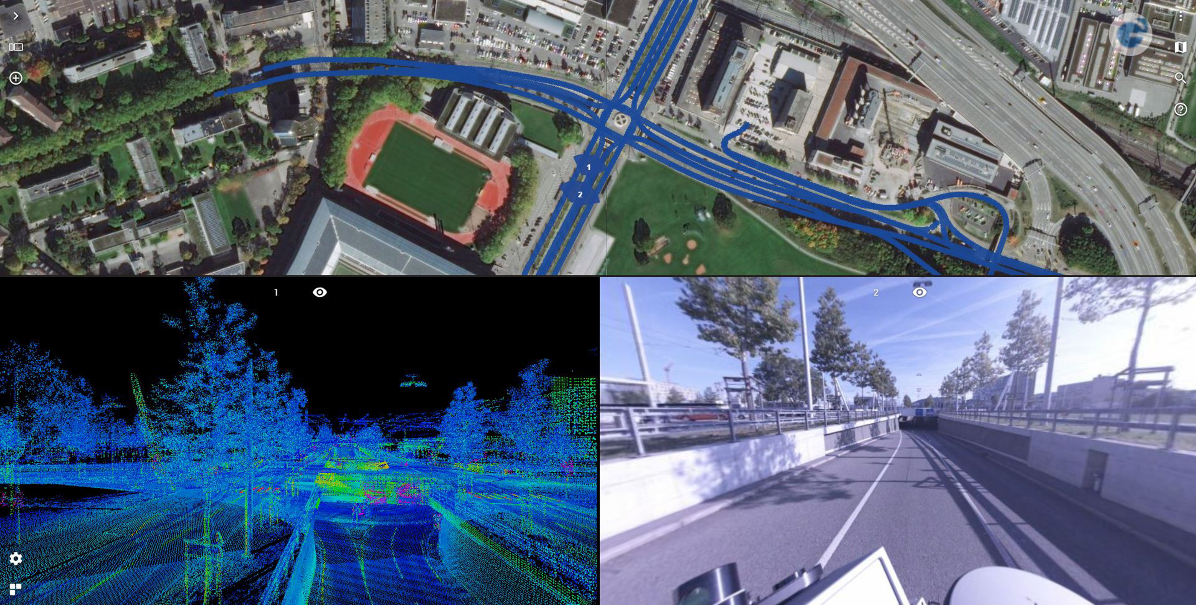
Road Management in Bern, Switzerland
Until the realisation of the herein presented solution, it was inconceivable to view several thousand kilometres of point cloud and over 1.4 million images using standard computers at a public authority ...


