GEO Business is shaping up to be one of the most important shows in the geospatial calendar, with 3000 international visitors expected to attend. Orbit GT hosts a booth and shows its version 17.1 desktop solutions for Mobile Mapping, Indoor Mapping, UAS Mapping and Oblique Mapping. Orbit GT will be presenting on Tuesday May 23rd (ROOM 4, 10:15 am) focusing on its newest product “3D Mapping Cloud”: the primary way to share Mobile, Terrestrial, Indoor, UAV and Oblique Mapping data, via any browser, any platform, via plugins and integrations in any 3rd party application.
Being experts in the management of big data in domains of Mobile Mapping, UAS Mapping, Oblique Mapping and Indoor Mapping, a cloud based product is the logical next step. It is my strong belief that anyone using large volumes of point clouds and/or imagery will be thrilled by this product. The flexible, versatile, and hardware neutral solution is exactly what many organizations have been waiting for.
The 3D Mapping Cloud is a self-managed solution to exploit vast volumes of 3D Mapping data, typically collected as LiDAR or Image data. This product brings the ease of sharing, re-use, fusion or sources and integration of petabytes of data accessible for everyone in the business, from high-end engineering point cloud streaming to publishing up-to-date imagery for the public at large.
Check out www.3Dmapping.cloud.
Visit us at Stand N6
Business Design Centre
London, UK
Tuesday May 23rd: 9:00am – 6:00pm
Wednesday May 24th: 9:00am – 4:00pm

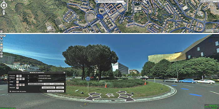
Municipality of Donostia/ San Sebastián
Open government and transparency are the key components of a modern municipal strategy. With these core principles in mind, the city council of Donostia/San Sebastián decided to embed Orbit 3DM Publisher in its web environment, in order to provide its citizens with the most accurate and up-to-date maps of the city ...