Orbit GeoSpatial Technologies will show new Mobile Mapping integrations in Esri’s ArcOnline and Web App Builder at the Esri Partner Conference, Palm Springs.
“Our Esri integrations will change the way the Esri community looks at Mobile Mapping content”, says Peter Bonne, CEO of Orbit GT. “At the upcoming Esri Partner Conference, we will showcase our new technologies to embed in ArcOnline, and provide a widget for the Web App Builder so any developer can take advantage of it.”
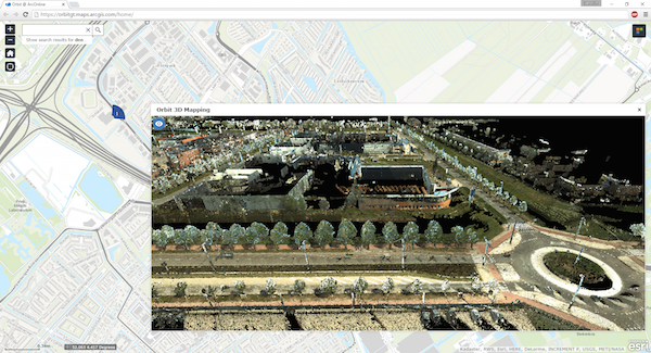
Orbit GT’s new technology supports streaming of imagery and point clouds of unlimited size directly into ArcOnline. The technology makes Mobile Mapping, from Street Level Imagery up to the vast point clouds representing a complete city or corridor in full 3D, available from within any web page built with ArcOnline or the Web App Builder. It includes Orbit’s unique support for all and any mobile mapping system, introducing a first-of-its-kind standard for this type of content in the Geospatial Business.
See you at booth 104.
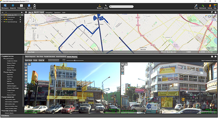
La Matanza, Argentina, optimizes public advertising using Mobile Mapping
The survey and identification of public advertizement space for the calculation of the advertising rights of La Matanza allows the city to quantify and typify all the installations and/or advertising elements through which the economic activity of a certain social actor is developed and materialized according to the ordinance tariff 2017 for the advertising rights of the municipality of La Matanza ...


