Orbit GT is proud to announce that Vexcel Imaging, Austria, has been selected as Reseller of Orbit GT Oblique, Mobile Mapping and Indoor Mapping software products.
“We are very happy to have signed a Reseller Agreement with Vexcel Imaging, for many years a world leading provider of imaging hardware worldwide”, says Peter Bonne, CEO of Orbit GT. “With Vexcel’s expertise on aerial imaging, and the new products for vehicle based and man portable solutions, we see a perfect fit for an exceptionally good relationship. Together we will be serving our joint customers with superior tools and workflows helping to enable their success.”
Alexander Wiechert, CEO of Vexcel Imaging, is also looking forward to the partnership.: “After the first meeting with the Orbit GT team, we immediately knew that this is the right partner for us. Orbit GT brings in a lot of expertise and experience in mapping solutions that perfectly complement our own existing solutions. Exploiting such combined synergies strengthens both our product portfolios and at the end brings a lot of enhanced benefits and new business opportunities to our worldwide customers.”
About Vexcel Imaging
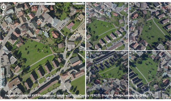
Vexcel Imaging, based in Austria, taps into more than two decades of photogrammetry expertise offering state-of-the-art digital aerial and terrestrial sensor systems based on the latest and most-advanced technology. The system family is complemented by the fully integrated processing software UltraMap delivering exceptional quality point clouds, DSMs and ortho imagery.
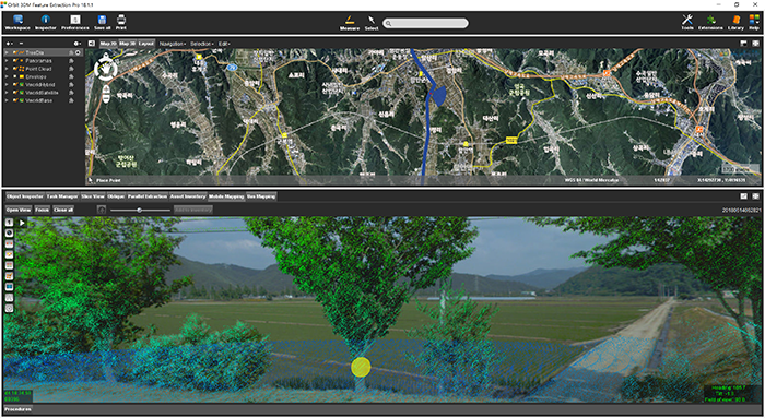
Managing Street-side trees in South Korea
This project is to construct a system for street tree maintenance that will systematically perform tasks related to street tree growth, repelling insect attacks, statistics for urban planning and more. Initiated in June 2018 by the local government of Haman city in Kyungnam Province, South Korea, completion is due by November 2018 ...


