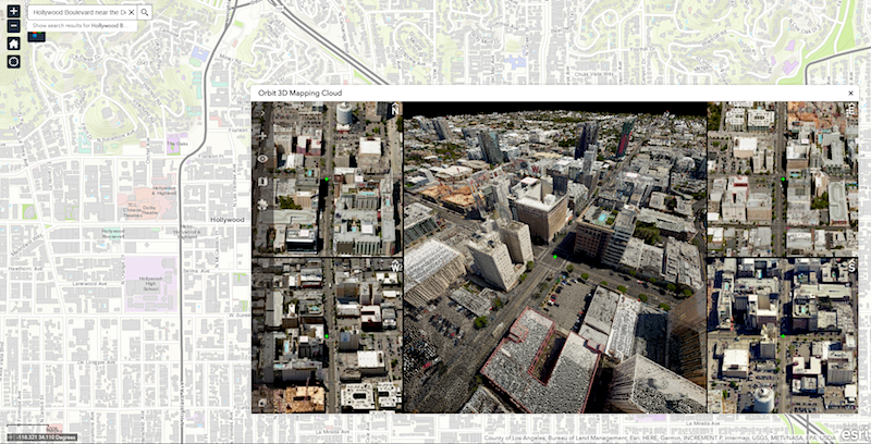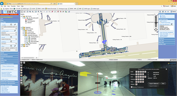
Orbit GT and Vexcel Imaging will be showcasing an integrated solution for Aerial Oblique and streetlevel Mobile Mapping data, operational within ArcOnline, at Esri IMF and UC, San Diego, July 8-13.
“We’re pleased to announce that Vexcel Imaging and Orbit GT will be showcasing Vexcel Aerial Oblique data and streetlevel Mobile Mapping data in a single integrated application within ArcOnline”, says Peter Bonne, CEO of Orbit GT. “ We’ve been supporting Oblique Imagery and Mobile Mapping data for several years in ArcGIS Desktop, and now we’re fusing these complex datasets together in a single solution based on our 3dmapping.cloud SaaS platform, integrated in ArcOnline using a standard Widget. It is a great leap forward to disclose highly valuable content to many users, extremely valuable for decision making.”
“We have been looking for an application that combines both data, UltraCam aerial oblique data as well as streetlevel Mobile Mapping data from our UltraCam Mustang, for a long time. Having now the possibility to combine these data in a single integrated application opens up great new opportunities for our customers”, says Alexander Wiechert, CEO of Vexcel Imaging.
The showcase integrates over 3TB of aerial oblique and streetlevel data in ArcOnline. It includes viewing of 4 oblique images in sync, steaming 3D point clouds from oblique dense matching and streetlevel LiDAR combined, and thousands of high resolution spherical streetlevel images. Measurements can be made in any of the views or datasets and with equal ease and precision.
Please join Vexcel Imaging on booth M200 at the Esri IMF, July 8-9, Manchester Grand Hyatt and booth 831 at the Esri UC, July 11-13, San Diego Convention Center.
Please join Orbit GT on booth 1930 at the Esri UC, July 11-13, San Diego Convention Center.


