Orbit GeoSpatial Technologies is pleased to announce the launch of the Mobile Mapping plugin for AutoCAD MAP.
“We’re pleased to announce that from today, every AutoCAD user now has access to the vast volumes of Mobile Mapping data”, says Peter Bonne, CEO of Orbit GT. “By connecting to our Publisher, the AutoCAD MAP user consumers spherical imagery and point cloud data of unlimited volume and size right onto the desktop.”
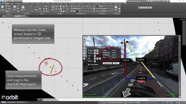
With the Orbit GT plugin for AutoCAD MAP, the use of native Mobile Mapping content becomes very easy. Any challenge of volume and performance is tackled by the Orbit Publisher. Users can simply measure, copy any measurement into AutoCAD Map, and overlay AutoCAD Map features on the Mobile Mapping imagery. Very powerful indeed!
Have a look here : https://youtu.be/JYNjYZGX-t4?list=PLE9Z5YdkIco96GACTmb_9zl8GOkRTk6MO
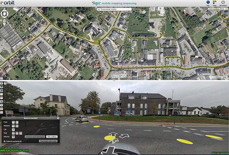
Flemish Government maps all streets
Based on a successful first round in 2008-2010, and on popular demand, the flanders geographical information agency (fgia) has decided to tender a second round of mobile mapping, covering all issues learned from round one ...


