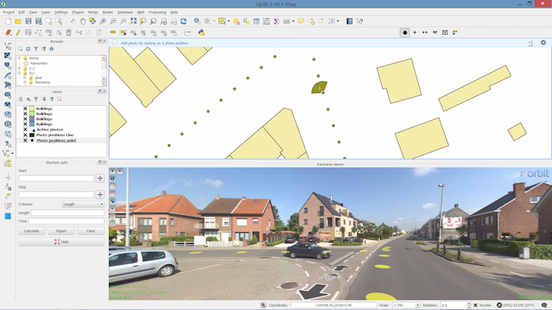
Orbit GeoSpatial Technologies is pleased to announce the launch of the Mobile Mapping plugin for QGIS.
“We’re pleased to announce that from today, every QGIS user now has access to the vast volumes of Mobile Mapping data”, says Peter Bonne, CEO of Orbit GT. “By connecting to our Publisher, the QGIS user consumers spherical imagery and point cloud data of unlimited volume and size right onto the desktop.”
With the Orbit GT plugin for QGIS, the use of native Mobile Mapping content becomes very easy. Any challenge of volume and performance is tackled by the Orbit Publisher. Users can simply measure, copy any measurement into QGIS, and overlay QGIS features on the Mobile Mapping imagery. Very powerful indeed!
Have a look here : https://youtu.be/ZIkcOHmJJhI
Vista 360: The digital transformation of Street Management in Costa Rica
One of the most important tasks of municipalities is managing their territory. This task is a daily challenge, because there are many variables: the maintenance of streets, sidewalks, piping, signage, trade, education, housing and factories. Not to mention the constant search for a balance between the quality of life of citizens and a responsibility for the environment ...


