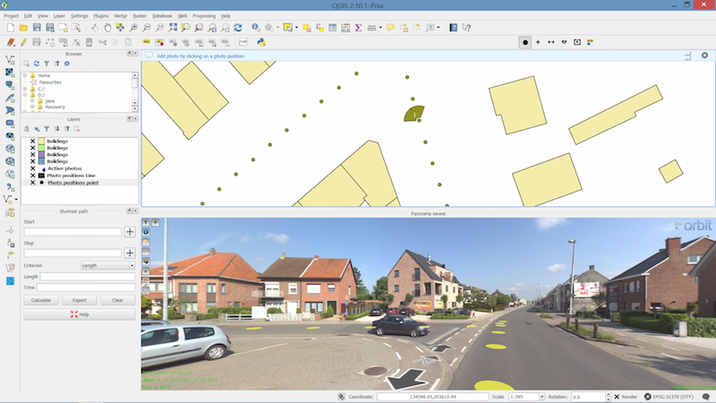
Orbit GeoSpatial Technologies is pleased to announce the launch of the Mobile Mapping plugin for QGIS.
“We’re pleased to announce that from today, every QGIS user now has access to the vast volumes of Mobile Mapping data”, says Peter Bonne, CEO of Orbit GT. “By connecting to our Publisher, the QGIS user consumers spherical imagery and point cloud data of unlimited volume and size right onto the desktop.”
With the Orbit GT plugin for QGIS, the use of native Mobile Mapping content becomes very easy. Any challenge of volume and performance is tackled by the Orbit Publisher. Users can simply measure, copy any measurement into QGIS, and overlay QGIS features on the Mobile Mapping imagery. Very powerful indeed!
Have a look here : https://youtu.be/ZIkcOHmJJhI

Bringing 3D Mapping to the people of Kuwait
In the past, people in Kuwait struggled to find a specific building. The Public Authority for Civil Information (PACI) intervened, inventing an address system that is unique in the world: The ‘Kuwait Finder’, an application for the public, governmental and private sectors. PACI now intends to also provide a full 3D map service for the country, which will allow users to see the streets of Kuwait in realistic 3D panoramic ...
Read More
Read More
It is very important for us to empower our Kuwaiti national youth with the knowledge and expertise about this new technology to the level at which they become a national reference in this high tech.


