“This is quite some upgrade : full of new capabilities at very aggressive prices,”, says Peter Bonne, CEO of Orbit GT. “With this upgrade, 3D Mapping Cloud basically renders all other platforms obsolete. We’ve got all Reality Capture systems covered, we’ve got multi-sensor systems covered, we’ve got real time fusion and CRS transformation covered, and now we throw in 100GB free storage and 5 free guest users for everyone.”
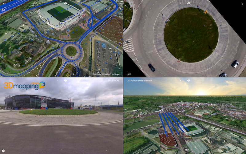
3D Mapping Cloud is Orbit GT’s SaaS platform designed to host, process and share massive volumes of LiDAR, Imagery and other reality capture data, however it has been collected. It supports high resolution street-level or Indoor Mobile Mapping up to aerial Oblique mapping, each with fully automated adapted viewer behaviour. Data can be shared informally using a 1-click Bookmark, or via a formal nicely setup Publication.
This new upgrade also inlcudes a single user subscription for only $46/month, also including 100 GB and 5 guest users for free. Check it out today !
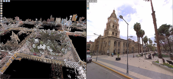
Mobile Mapping to improve water utility services in Bolivia
SEMAPA, a water utility company located in the city of Cochabamba (Bolivia) launched a competitive bidding to find a company that brings to the table a viable solution to update, visualize, manage and measure their field assets and pipe network information, knowing that they had serious budgetary restrictions; assets and pipe network were stretched out over an area covering around 3.000 hectares; the starting point was an outdated and most ...


