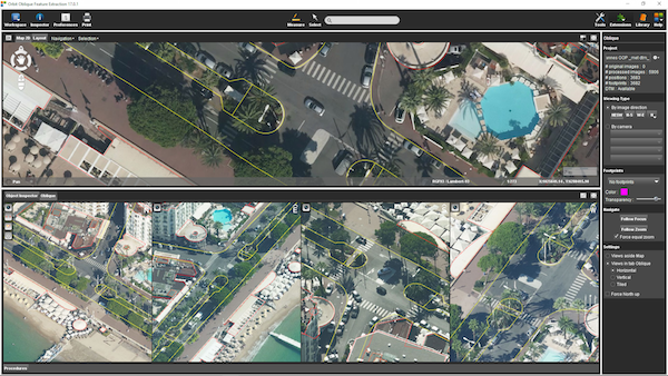
“Oblique Mapping v17 is cool upgrade”, says Peter Bonne, CEO of Orbit GT. “Whilst having improved import and support for many more camera systems, we’ve added some cool features that adds significantly to the user experience and the feature extraction capabilities.”
Orbit Oblique Mapping supports all oblique camera systems, and has documented procedures for Vexcel Imaging, MIDAS, ASPRS conform specifications and others. Through the addition of a camera-choice setting, systems with more than 4 camera’s are now also supported.
Orbit Oblique Mapping allows measurements, feature extraction, vector overlays and many more. It’s the most complete product to exploit any oblique imagery for any application.
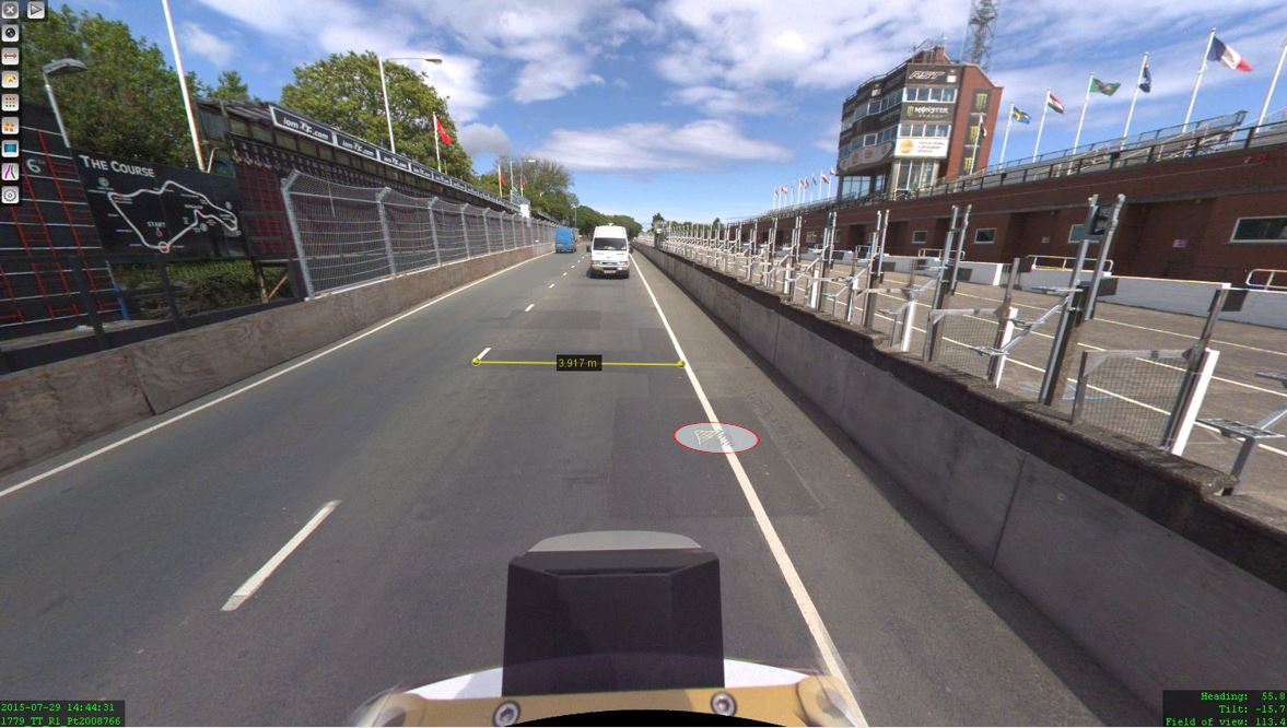
The Isle of Man: TT race mobile mapped for highway asset management and gaming
When LandScope Engineering was commissioned by the Isle of Man Government to accurately map both the TT and Southern 100 routes for the purposes of highway asset inventory and visualisation and to meet future 3D gaming and simulation requirements, a compelling and innovative solution was required ...


