Orbit GT releases v17.1 of its Oblique Mapping desktop product including the all-new Upload to the Cloud feature. It is available for download today from our website www.orbitgt.com.
“This upgrade includes the capability to upload any Oblique Mapping content directly to www.3dmapping.cloud, our SaaS based sharing and collaboration platform”, says Peter Bonne, CEO of Orbit GT. “It adds a great new feature for everyone producing and exploiting oblique aerial imagery.”
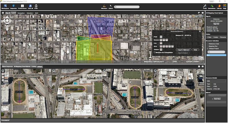
‘Upload to the Cloud’ allows for users to instantly bring Oblique Aerial imagery data online. The upload process is fluently integrated in the known workflows of the product, with the required checks and validations. Upload time depends on your internet connection. Once uploaded, the data is immediately available for sharing on www.3dmapping.cloud. The new Catalog tool adds insight and overview of all data collection jobs done, indispensable to manage large jobs.
This product is available for download today on www.orbitgt.com. This update is free for holders of a license with maintenance.

The Isle of Man: TT race mobile mapped for highway asset management and gaming
When LandScope Engineering was commissioned by the Isle of Man Government to accurately map both the TT and Southern 100 routes for the purposes of highway asset inventory and visualisation and to meet future 3D gaming and simulation requirements, a compelling and innovative solution was required ...
Read More
Read More
This innovative approach brings benefits in that one campaign may satisfy many different objectives.


