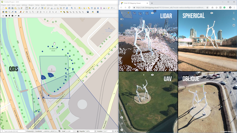
“We’re happy to announce the release of our new SDK for viewing and integrating massive 3D Mapping content into any workflow“, says Peter Bonne, CEO of Orbit GT. “At the same time, a brand new QGIS plugin based on this new SDK is now available for download.”
The 3D Mapping Viewer SDK has gone through a significant upgrade. We’ve gone the extra mile to simplify the API while adding more functionalities. The SDK is free to use and can be downloaded from www.orbitgt.com – do register as Developer.
The SDK comes in 3 languages : JS, .Net and Python. The latter has been used to built the Plugin for QGIS. This Plugin is available for download today on www.orbitgt.com, for free !
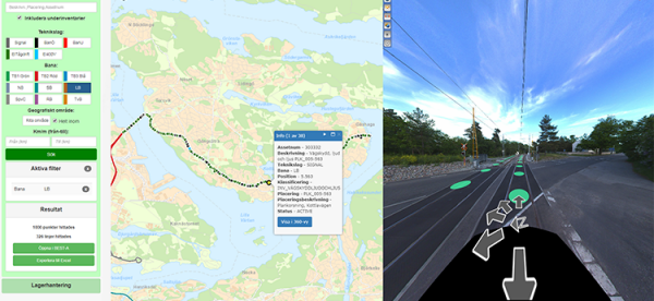
Stockholm Public Transport: Administration Rail Asset Management
The underground metro system has a history of more than half a century and has been updated and extended over the years. Daily maintenance and planned upgrades in the complex railway network have increased the need for an asset management system that provides with the necessary control and monitoring ...
Read More
Read More
The visualization of assets with stored relevant metadata, for instance, maintenance history, remarks or performed inspections, gives Stockholm Public Transport Administration full control of their infrastructure.


