
Orbit GT releases v17.1 of its UAS Mapping desktop product including the all-new Upload to the Cloud feature. It is available for download today from our website www.orbitgt.com.
“This upgrade includes the capability to upload any UAS Mapping content directly to www.3dmapping.cloud, our SaaS based sharing and collaboration platform”, says Peter Bonne, CEO of Orbit GT. “It adds a great new feature for everyone collecting and creating drone based content.”
‘Upload to the Cloud’ allows for users to instantly bring their drone/UAS/UAV data online. The upload process is fluently integrated in the known workflows of the product, with the required checks and validations. Upload time depends on your internet connection. Once uploaded, the data is immediately available for sharing on www.3dmapping.cloud. The new Catalog tool adds insight and overview of all data collection jobs done, indispensible to manage large jobs.
This product is available for download today on www.orbitgt.com . This update is free for holders of a license with maintenance.
Visit us at UAV Expo Europe, Brussels, June 20-22, at The Square.
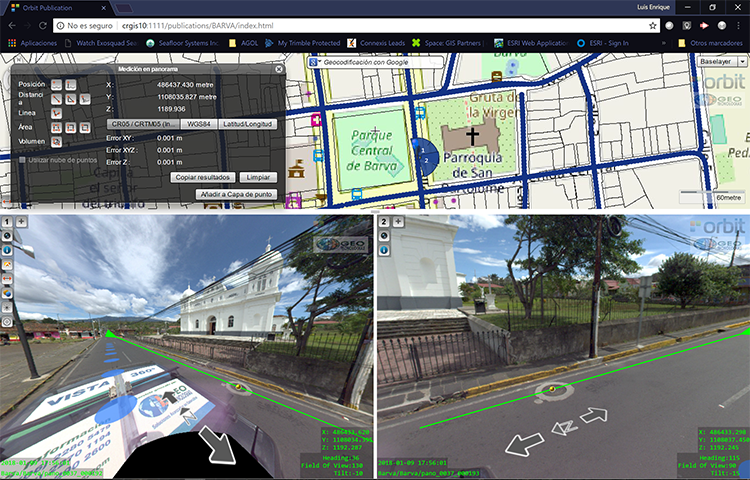
Vista 360: The digital transformation of Street Management in Costa Rica
One of the most important tasks of municipalities is managing their territory. This task is a daily challenge, because there are many variables: the maintenance of streets, sidewalks, piping, signage, trade, education, housing and factories. Not to mention the constant search for a balance between the quality of life of citizens and a responsibility for the environment ...


