
Orbit GT releases v17.1 of its UAS Mapping desktop product including the all-new Upload to the Cloud feature. It is available for download today from our website www.orbitgt.com.
“This upgrade includes the capability to upload any UAS Mapping content directly to www.3dmapping.cloud, our SaaS based sharing and collaboration platform”, says Peter Bonne, CEO of Orbit GT. “It adds a great new feature for everyone collecting and creating drone based content.”
‘Upload to the Cloud’ allows for users to instantly bring their drone/UAS/UAV data online. The upload process is fluently integrated in the known workflows of the product, with the required checks and validations. Upload time depends on your internet connection. Once uploaded, the data is immediately available for sharing on www.3dmapping.cloud. The new Catalog tool adds insight and overview of all data collection jobs done, indispensible to manage large jobs.
This product is available for download today on www.orbitgt.com . This update is free for holders of a license with maintenance.
Visit us at UAV Expo Europe, Brussels, June 20-22, at The Square.
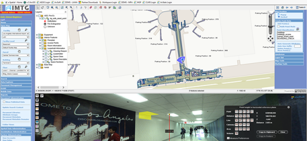
Indoor mapping at Los Angeles Airport: A Complex Spatial Story
Collecting and managing spatial data at airports is challenging. Just about everything in the airport needs to be tracked. From pavement management, runway markings and lighting to indoor space usage, equipment’s and signage, all of these need to be integrated with various environmental, safety, security, operational or facility and maintenance management tools ...
Read More
Read More
Orbit GT’s software and built in workflows have raised the bar of indoor mapping at airports.


