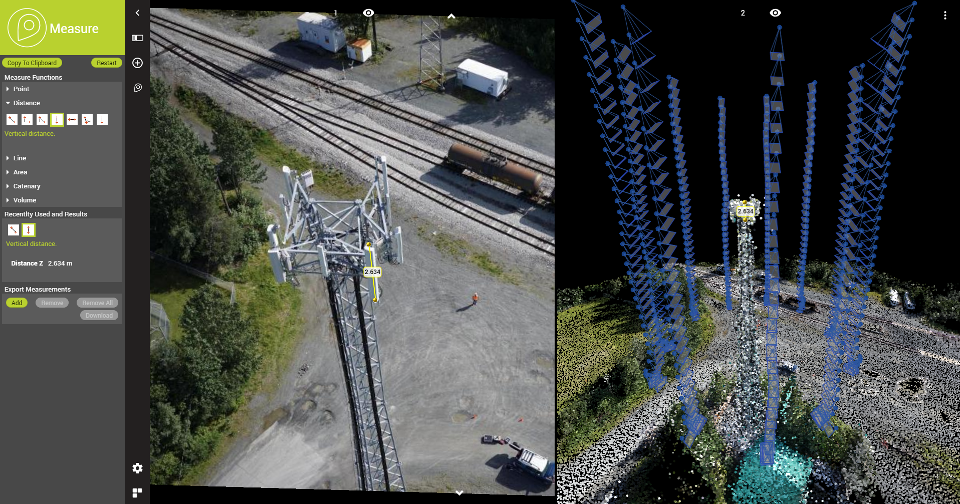
Orbit GT supports all types of UAV imagery in its desktop products and SaaS product 3dmapping.cloud.
“It’s great to announce that our latest releases support the various image content produced by UAVs”, says Peter Bonne, CEO of Orbit GT. “while mapping projects produce Nadir images, other projects like pole inspection produce front-facing or oblique imagery. All of these are now seamlessly integrated in our desktop and online portfolio.”
Whichever job you need to to, your drone data can be digested by all Orbit GT products. Use the Nadir imagery to go for mapping. Use forward-facing images or oblique images for inspection and observation projects. In both cases you can opt for dense matching to generate a point cloud or textured mesh. In every situation, details can be viewed, measured and extraction with the same ease of use.
When using 3dmapping.cloud, you can share with a customer or contractor in a single click!
Checkout www.3dmapping.cloud.
Mobile Mapping to improve water utility services in Bolivia
SEMAPA, a water utility company located in the city of Cochabamba (Bolivia) launched a competitive bidding to find a company that brings to the table a viable solution to update, visualize, manage and measure their field assets and pipe network information, knowing that they had serious budgetary restrictions; assets and pipe network were stretched out over an area covering around 3.000 hectares; the starting point was an outdated and most ...
Read More
Read More
Geospatial information is crucial to properly manage companies whose assets are fully deployed on the field, as in the case of a water utility


