
GEO Business is shaping up to be one of the most important shows in the geospatial calendar, with 3000 international visitors expected to attend. Orbit GT hosts a booth and shows its version 17.1 desktop solutions for Mobile Mapping, Indoor Mapping, UAS Mapping and Oblique Mapping. Orbit GT will be presenting on Tuesday May 23rd (ROOM 4, 10:15 am) focusing on its newest product “3D Mapping Cloud”: the primary way to share Mobile, Terrestrial, Indoor, UAV and Oblique Mapping data, via any browser, any platform, via plugins and integrations in any 3rd party application.
Being experts in the management of big data in domains of Mobile Mapping, UAS Mapping, Oblique Mapping and Indoor Mapping, a cloud based product is the logical next step. It is my strong belief that anyone large volumes of using point clouds and/or imagery will be thrilled by this product. The flexible, versatile, and hardware neutral solution is exactly what many organizations have been waiting for.
The 3D Mapping Cloud is a self-managed solution to exploit vast volumes of 3D Mapping data, typically collected as LiDAR or Image data. This product brings the ease of sharing, re-use, fusion or sources and integration of petabytes of data accessible for everyone in the business, from high-end engineering point cloud streaming to publishing up-to-date imagery for the public at large.
Check out https://www.3dmapping.cloud or Visit us at booth N6
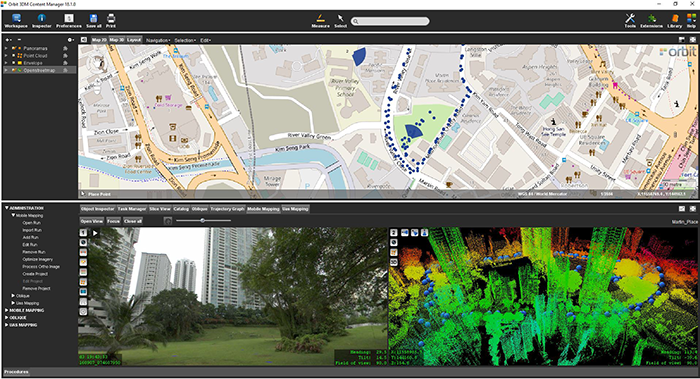
Singapore Smart Nation
As part of singapore’s quest to be a smart nation, the Singapore Land Authority (sla) embarked on a 3D national mapping initiative in 2014. This initiative aims to create and maintain an accurate national 3D map that is developed once and used by many ...


