Orbit GT will be showing a range of high quality and high volume RIEGL data in the Esri platform.
“We’re pleased to announce that Aerial, UAV, Terrestrial Indoor and Outdoor Mapping data collected with high end RIEGL systems will be shown at the Esri UC, based on Orbit GT’s 3D Mapping Cloud integrated in ArcOnline and ArcGIS Pro”, says Peter Bonne, CEO of Orbit GT. “Join us on Orbit GT booth #333.”
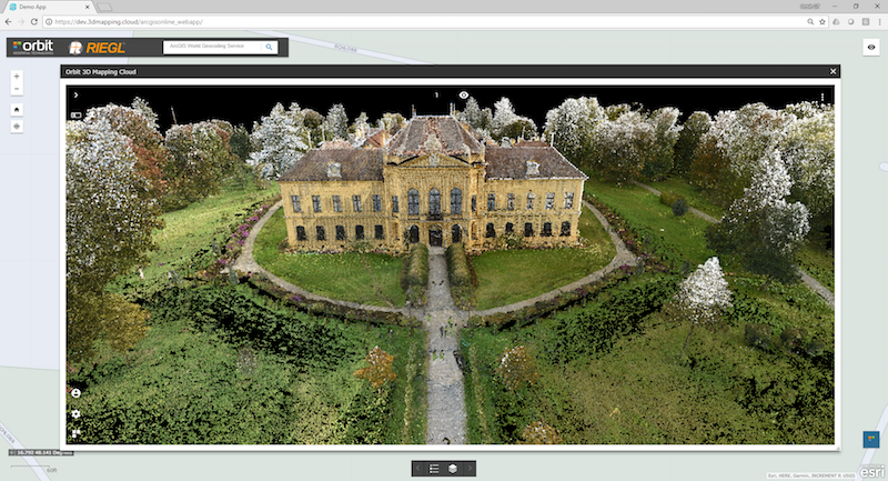
3D Mapping Cloud is Orbit GT’s SaaS platform designed to host, process and share massive volumes of LiDAR, Imagery and other reality capture data, however it has been collected. It supports high resolution Mobile Mapping as well as aerial Oblique mapping, each with fully automated adapted viewer behavior. Data can be shared informally using a 1-click Bookmark, or via a formal nicely setup Publication.
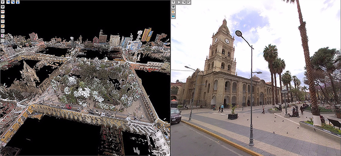
Mobile Mapping to improve water utility services in Bolivia
SEMAPA, a water utility company located in the city of Cochabamba (Bolivia) launched a competitive bidding to find a company that brings to the table a viable solution to update, visualize, manage and measure their field assets and pipe network information, knowing that they had serious budgetary restrictions; assets and pipe network were stretched out over an area covering around 3.000 hectares; the starting point was an outdated and most ...


