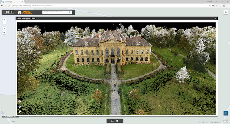
Orbit GT will be showing a range of high quality and high volume RIEGL data in the Esri platform.
“We’re pleased to announce that Aerial, UAV, Terrestrial Indoor and Outdoor Mapping data collected with high end RIEGL systems will be shown at the Esri UC, based on Orbit GT’s 3D Mapping Cloud integrated in ArcOnline and ArcGIS Pro”, says Peter Bonne, CEO of Orbit GT. “Join us on Orbit GT booth #333.”
3D Mapping Cloud is Orbit GT’s SaaS platform designed to host, process and share massive volumes of LiDAR, Imagery and other reality capture data, however it has been collected. It supports high resolution Mobile Mapping as well as aerial Oblique mapping, each with fully automated adapted viewer behavior. Data can be shared informally using a 1-click Bookmark, or via a formal nicely setup Publication.
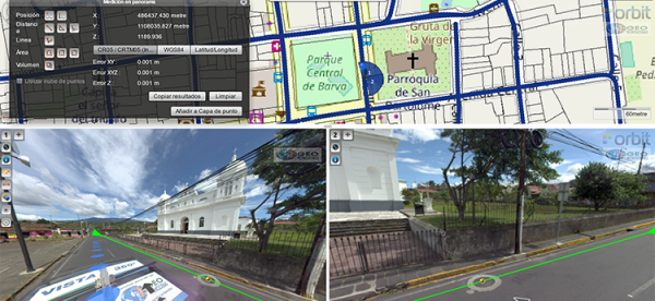
Vista 360: The digital transformation of Street Management in Costa Rica
One of the most important tasks of municipalities is managing their territory. This task is a daily challenge, because there are many variables: the maintenance of streets, sidewalks, piping, signage, trade, education, housing and factories. Not to mention the constant search for a balance between the quality of life of citizens and a responsibility for the environment ...
Read More
Read More
It has always been a challenge, not just to take daily measurements in order to take effective actions, but also to properly record these measurements.


