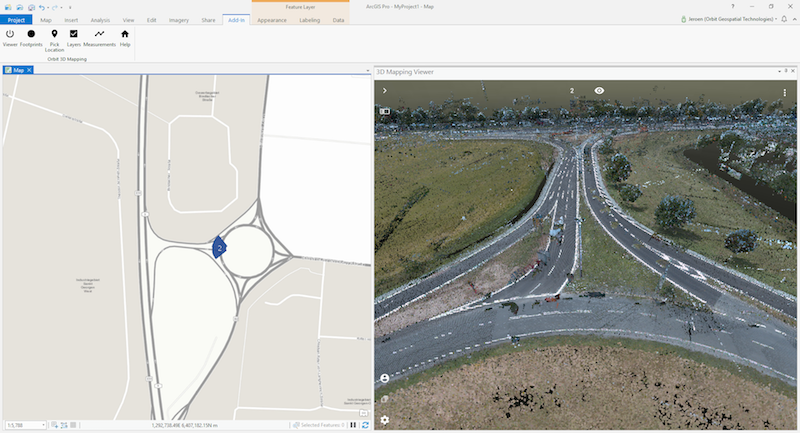
Orbit GT and Trimble will be showing content from the new MX9 integrated in the Esri platform.
“We’re pleased to anounce that Mobile Mapping content from Trimble’s new MX9 system will be shown at the Esri UC, based on Orbit GT’s 3D Mapping Cloud integrated in ArcOnline and ArcGIS Pro”, says Peter Bonne, CEO of Orbit GT. “The data from this brand new system will be show on both the Trimble and Orbit GT (#333) booths.”
3D Mapping Cloud is Orbit GT’s SaaS platform designed to host, process and share massive volumes of LiDAR, Imagery and other reality capture data, however it has been collected. It supports high resolution Mobile Mapping as well as aerial Oblique mapping, eacht with fully automated adapted viewer behavior. Data can be shared informally using a 1-click Bookmark, or via a formal nicely setup Publication.
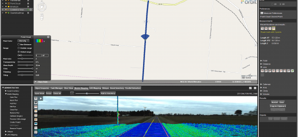
Mobile Mapping Redefines Pavement Marking Inventory in Ohio
It began with the Richland County Ohio Engineer’s office. They set out to inventory and inspect all their roadway pavement markings. The Richland County Engineer, Adam Gove, P.E., P.S., stated, “When evaluating the condition of our County Roads, it became clear that our pavement marking inventory was out of date. We did not have an effective way of tracking which roads had pavement markings, when they were last repainted, and ...
Read More
Read More
At MasterMind, we saw so much potential for the U.S. County governments to utilize the 3D Mapping Cloud along with the 3DM Plugin for ArcMap, that as of May 28th, 2019, MasterMind teamed with Orbit GT to become an official reseller for Orbit GT software. We look forward to continually spreading the word and praise of Orbit GT’s mobile mapping software, along with mobile mapping in general.


