Orbit GT updates 3D Mapping Cloud with faster Performance, new Measurement tools, subscription plans and storage options, and much more.
“This major upgrade of 3D Mapping Cloud brings great new capabilities to the geospatial business.” says Peter Bonne, CEO of Orbit GT. “It now allows customers to register on a plan for multipe users at once, and reserve storage space at challenging prices. Co-workers can get invited easily to join the online platform and commonly share all corporate resources with a simple click. On the technical side, significant performance improvements have been implemented to access huge volumes of point clouds and imagery even faster. We’ve also added a ton of new measurement tools. Check out our blog on www.3dmapping.cloud to read more about it.”
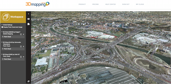
The 3D Mapping Cloud is a self-managed solution to exploit vast volumes of 3D Mapping data, typically collected as LiDAR or Image data. This product brings the ease of sharing, re-use, fusion or sources and integration of petabytes of data accessible for everyone in the business, from high-end engineering point cloud streaming to publishing up-to-date imagery for the public at large.
Stockholm Public Transport: Administration Rail Asset Management
The underground metro system has a history of more than half a century and has been updated and extended over the years. Daily maintenance and planned upgrades in the complex railway network have increased the need for an asset management system that provides with the necessary control and monitoring ...


