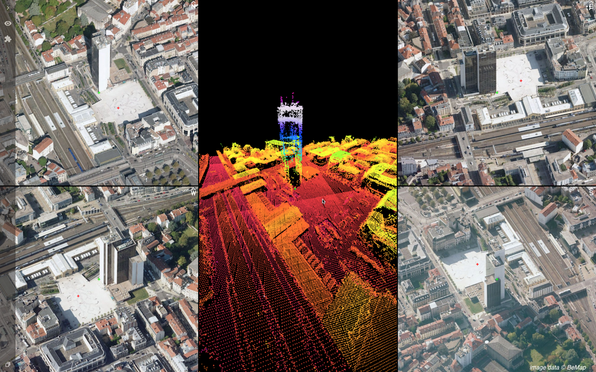
“After support for Mobile Mapping and UAS Mapping content, we now proudly announce the support for Oblique Imagery and Aerial Point Clouds. From now on, anyone owning Oblique data can upload this data and share in seconds.”, says Peter Bonne, CEO of Orbit GT. “Furthermore, Oblique content can be immediately fused with Mobile and UAS Mapping content, on the fly. Gone are IT challenges, server installations or website building – it’s right there, out of the box.”
An Oblique Aerial project can include a point cloud, either dense matched or LiDAR, and a DEM grid. Oblique data is immediately supported by pre-existing functionality, such as measurements and sharing of resources. The Viewer system supports 4 viewing directions and a centrally placed 2D/3D reference map. Navigation is both easy and intuitive. Upload and proper preparation of the data is performed using the newly released Orbit Oblique Feature Extraction desktop software, available from www.orbitgt.com.
Join now on www.3dmapping.cloud. You must be a registered user to access the upload and sharing capabilities.
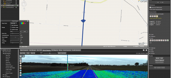
Mobile Mapping Redefines Pavement Marking Inventory in Ohio
It began with the Richland County Ohio Engineer’s office. They set out to inventory and inspect all their roadway pavement markings. The Richland County Engineer, Adam Gove, P.E., P.S., stated, “When evaluating the condition of our County Roads, it became clear that our pavement marking inventory was out of date. We did not have an effective way of tracking which roads had pavement markings, when they were last repainted, and ...
Read More
Read More
At MasterMind, we saw so much potential for the U.S. County governments to utilize the 3D Mapping Cloud along with the 3DM Plugin for ArcMap, that as of May 28th, 2019, MasterMind teamed with Orbit GT to become an official reseller for Orbit GT software. We look forward to continually spreading the word and praise of Orbit GT’s mobile mapping software, along with mobile mapping in general.


