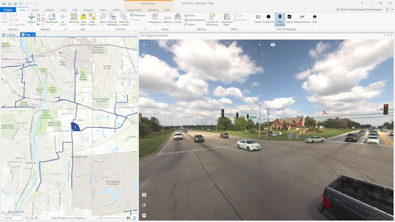
“The ArcGIS Pro add-in opens a complete new world to all ArcGIS Pro users”, says Peter Bonne, CEO of Orbit GT. “It provides access to massive 3D resources available in 3D Mapping Cloud right on your favorite desktop application. In one effort, you can now access terabytes of point clouds, spherical imagery, oblique imagery, UAV data and more in a single add-in. An add-in per data type has instantly become history.”
The Orbit GT add-in for ArcGIS Pro is built using the HTML5 based 3D Mapping Cloud Viewer SDK and has equal capabilities as the 3D Mapping Cloud web based Viewer. At the same time, this SDK also accesses the many installed on premise 3DM Publishers. So a single add-in provides access to public and private resources.
3D Mapping Cloud is Orbit GT’s SaaS platform designed to host, process and share massive volumes of LiDAR, Imagery and other reality capture data, however it has been collected. It supports high resolution Mobile Mapping as well as aerial Oblique mapping, each with fully automated adapted viewer behavior. Data can be shared informally using a 1-click Bookmark, or via a formal nicely setup Publication. Check it out today!
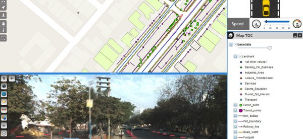
Streamlining the workflow of telecommunications in India
Besides very tight financial and inventory controls, maximum utilization of installed physical inventory and high quality of uninterrupted service to the customers, the biggest challenge faced by every Indian telecom company is the absence of a unified platform on which information pertaining to right of way, cable layout location and plans as well as individual asset locations are available ...
Read More
Read More
The spatial processing functionality provides the experiential feel of reality on the desktop


