The 3D mapping cloud will take us to another level, providing simple, scalable and cost-effective tools for the storage, analysis, visualization and integration of mobile mapping data.
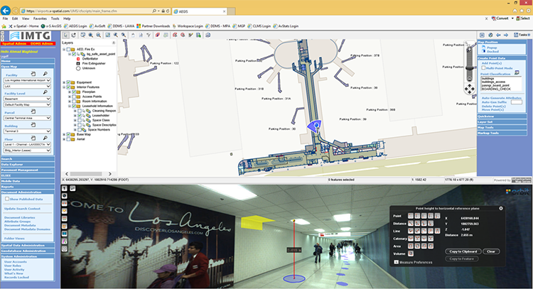
Indoor mapping at Los Angeles Airport: A Complex Spatial Story
Collecting and managing spatial data at airports is challenging. Just about everything in the airport needs to be tracked. From pavement management, runway markings and lighting to indoor space usage, equipment’s and signage, all of these need to be integrated with various environmental, safety, security, operational or facility and maintenance management tools ...


