Road and Rail Transportation's benefit of 3D Mapping
On a global scale, Road and Rail transport administrations, either public or private, are challenged with improvement and better management of their assets. These assets go beyond the physical pole, sign and alike. Road transportation is also keen on Road surface analysis, and Rail needs exact information on sign locations, gradients and stopping distances. Next to that, Rail also needs fully documented Rail Station context. Looks a perfect job for 3D Mapping.
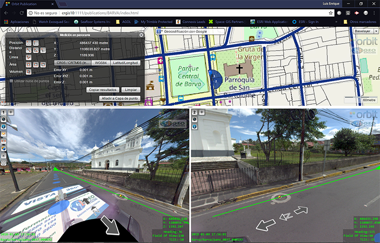
3D Mapping brings reality on your desktop. Cool. This eliminates countless site visits, provides more exact measurement techniques, and many more advantages for the end user. For any type of management of Road or Rail, 3D Mapping is a no-brainer.
Asset Inventories
Road and Rail administrations have many assets to manage. Asset inventories traditionally have been registered on paper, maybe scanned or not. But scanned paper is not quite the same as a well attributed database. Next to that, the list of assets might not be accurate nor complete. So, most likely, a novel inventory is at hand.
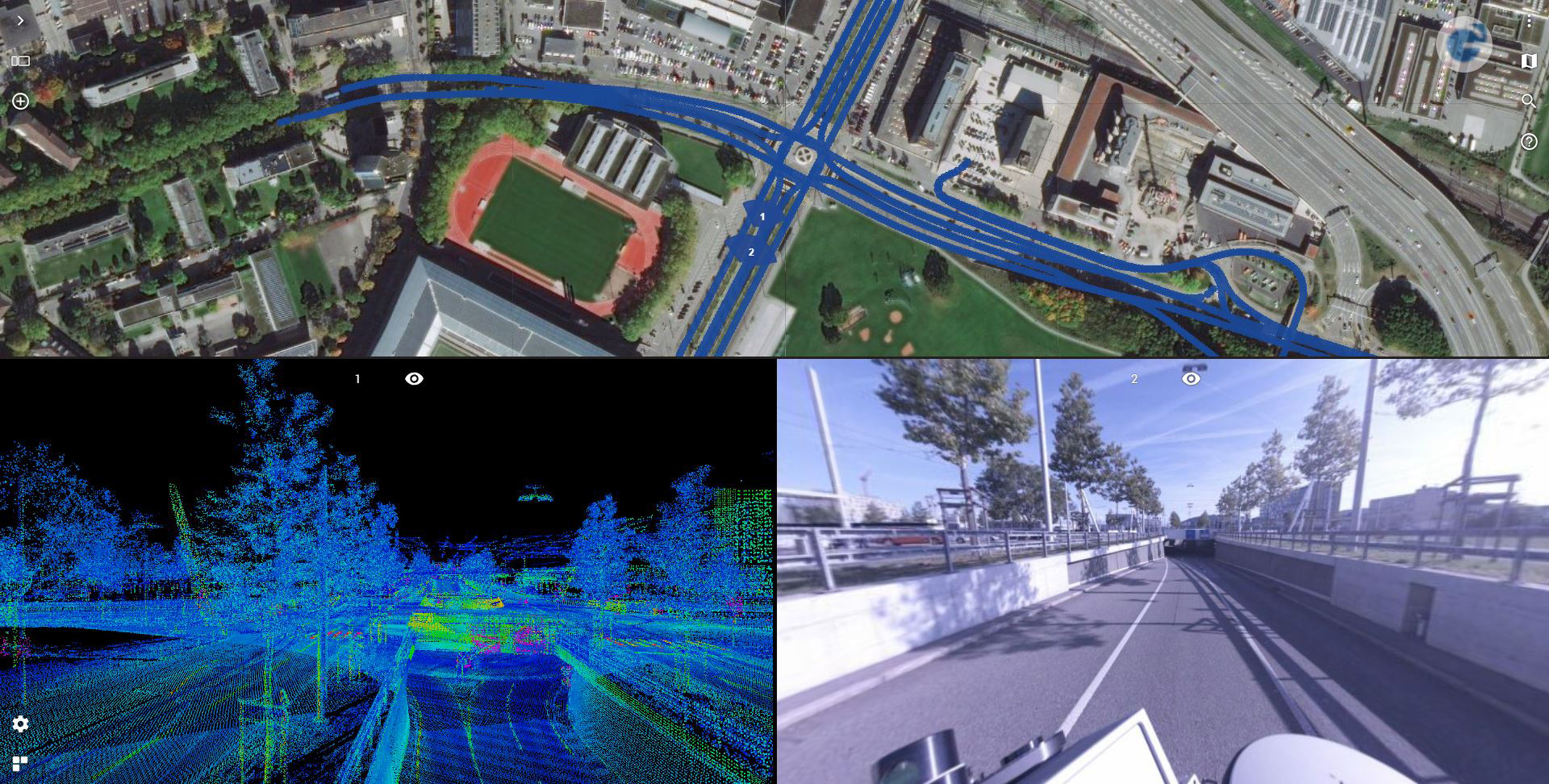
Fortunately, there’s one great way to go collect assets in the field, get an up-to-date inventory of the as-built situation, have all that well documented and attributed, put it in your database, and have it visually at your fingertips all at once. It’s called 3D Mapping. Mainly Mobile Mapping, assisted by drones, static scanning, aerial mapping.
If you’re looking at an inventory of poles, lights, traffic signs, road markings, curbstones, guard rails, or any other road-side asset, 3D Mapping is the way to go. However, there are 2 main challenges :
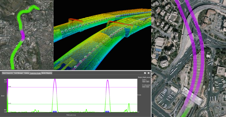
- Collecting 3D Mapping content on this size will generate massive volumes of data. How will we handle that?
- A great number of assets need to be identified, attributed and put in a database. How do we solve that?
Consider it solved. By Orbit GT.
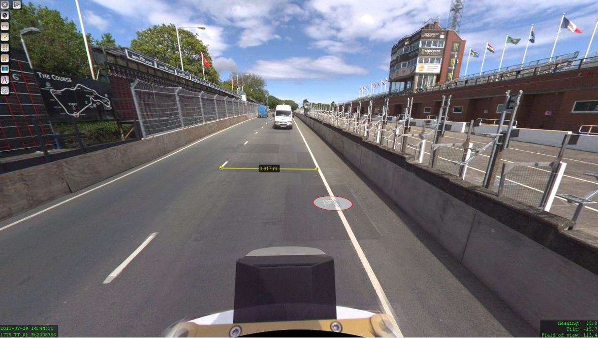
Road Surface, Clearances, ...
On the operational side, there are other challenges to be met. To name just a few :
- Road Surface Analysis : rutting, cracks, IRI, …
- Clearances : Bridges, tunnels, overhead signs, …
- Oversize Traffic : Clash detection, …
- Pavement separation, Sign reflectivity, …
These and much more elements can be extracted from the 3D Reality Capture content that has been collected via Mobile Mapping, Drone Mapping or other. To be fully equipped, one needs a platform that can digest the massive volumes of data, fuse various sources together, and integrate it in your workflow.
Implementation is made easy by a fully automated management of massive 3D data, a browser-based online viewer, and an SDK to embed this viewer into your workflows and preferred applications : integrations with Esri, QGIS, MicroStation, Autodesk platforms are available, but even so integrations with workflow systems or asset management solutions. The free SDK makes every integration a no-brainer.